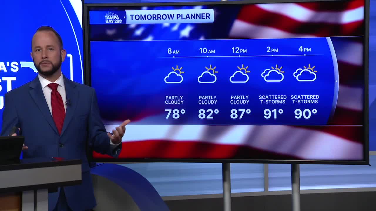


Expect a pretty decent chance of rain over the next seven days, even though storm coverage will come down a little as we head into Memorial Day and Tuesday. Slightly drier air aloft will drop the afternoon and evening storm chance to around 50%.
Highs stay hot over the next few days in the low to mid-90s, with heat indices of 100-103.
By the middle of the week, we'll see a big pattern shift compared to the last 7-12 days that have brought the late-day storms west to the coast. Winds have been out of the east and southeast which favors the West Coast for rain.
Wednesday, a west/southwest flow off the Gulf will bring in the better storm coverage at the coast during the morning hours with a push inland into the afternoon and evening.
That west/southwest wind flow will bring in deep tropical moisture, so even with the afternoon risk higher inland, scattered storms will still be possible at any time. The wind off the Gulf will help keeps temps in the mid to upper 80s as well.
