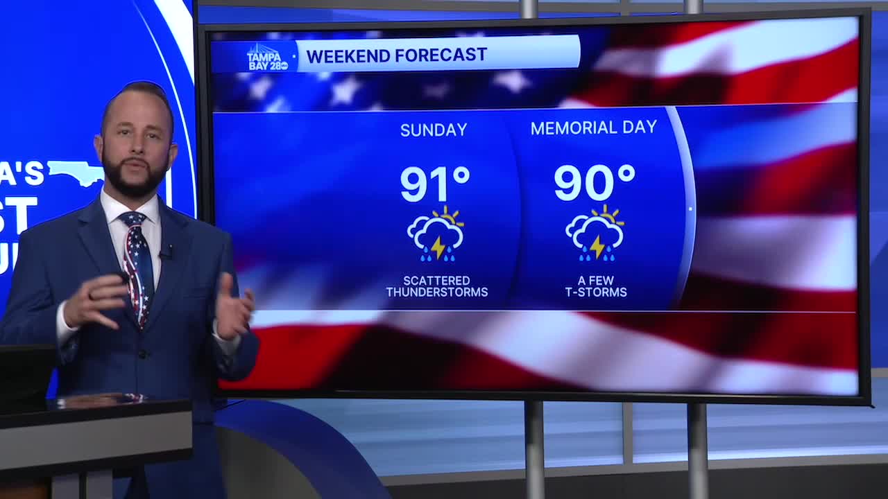


Expect another round of afternoon and evening showers and thunderstorms Sunday, but with a slight shift in the wind, rain chances should be higher along the coast by late Sunday afternoon into the evening. Storm coverage will top out at around 60%.
High temps stay hot before any showers and storms get going. We'll reach the low to mid 90s with heat indices above 100.
Memorial Day, we'll see a dry start for any early morning ceremonies you may be attending. Temps will begin in the mid to upper 70s. By the afternoon, rain chances head back up to around 50%, with areas along the I-75 corridor west to the coast a little more favored than inland.
By Wednesday, we'll see a huge pattern shift, and one that brings winds in off the Gulf. That changes the rain timing and coverage quite a bit compared to what we've seen for the last week. Best coverage for coastal areas will be in the morning to early afternoon, with many areas inland and over to the East Coast seeing the best rain chance by mid to late afternoon.
Temps should stay in the 80s as well with winds coming off the Gulf where water temps are currently in the low 80s.
