


Get those winter jackets back out of the closet! You're going to need them for a couple of days this week. After several days last week and even yesterday, our spring and even early summer-like weather is out of here. Another arctic front moved through the area this morning, and temperatures are beginning to fall.
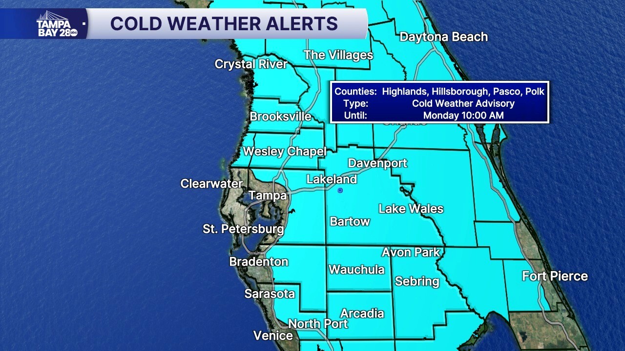
Monday morning, we have a Cold Weather Advisory in place for areas in light blue for wind chills that could be as low as 30! This morning, we had temps in the 60s and 70s! So, the feels like temperature will be 30-40° colder than our warm and muggy Sunday morning.
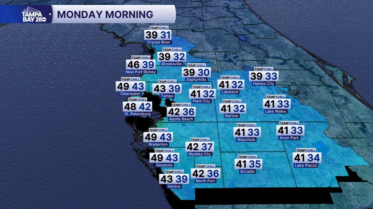
Temperatures will stay above freezing on Monday but will dip into the 30s north of I-4, with low 40s inland and mid to upper 40s along the coast.
Monday afternoon, we'll see beautiful sunny skies, but it will be chilly and breezy. Highs will struggle to reach the mid 50s, which is actually where our average lows are here in late February.
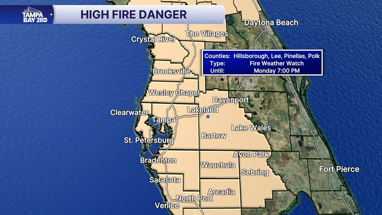
The gusty winds combined with very low humidity and our ongoing drought will make for a high fire danger. If a fire were to get started, it would spread rapidly in these conditions. A Fire Weather Watch is in effect and could be bumped up to warning by Monday morning.
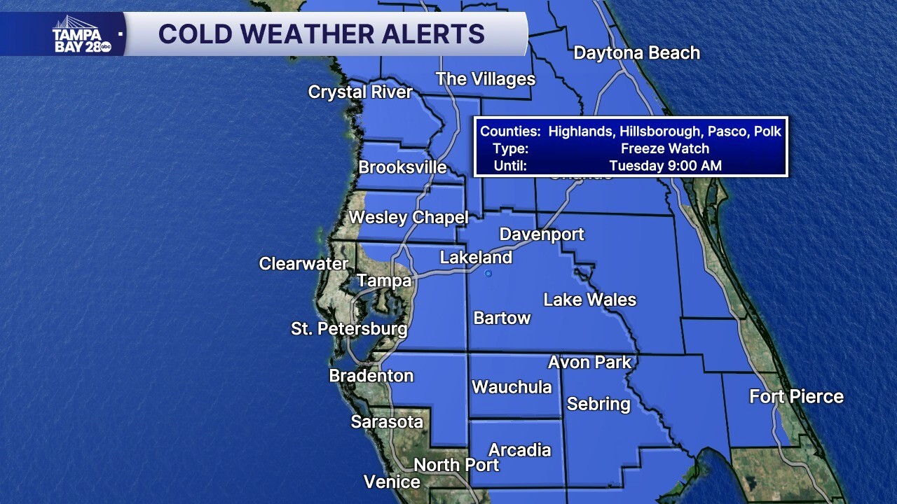
Tuesday morning will be the coldest of the next 7 days. Temps will fall into the upper 20s and low 30s north of I-4, with inland temps south in the low to mid 30s, with upper 30s and low 40s along the coast. A Freeze Watch is in effect for our inland spots and northern spots. Wind chills will dip into the 20s, so another Cold Weather Advisory will likely be issued.
