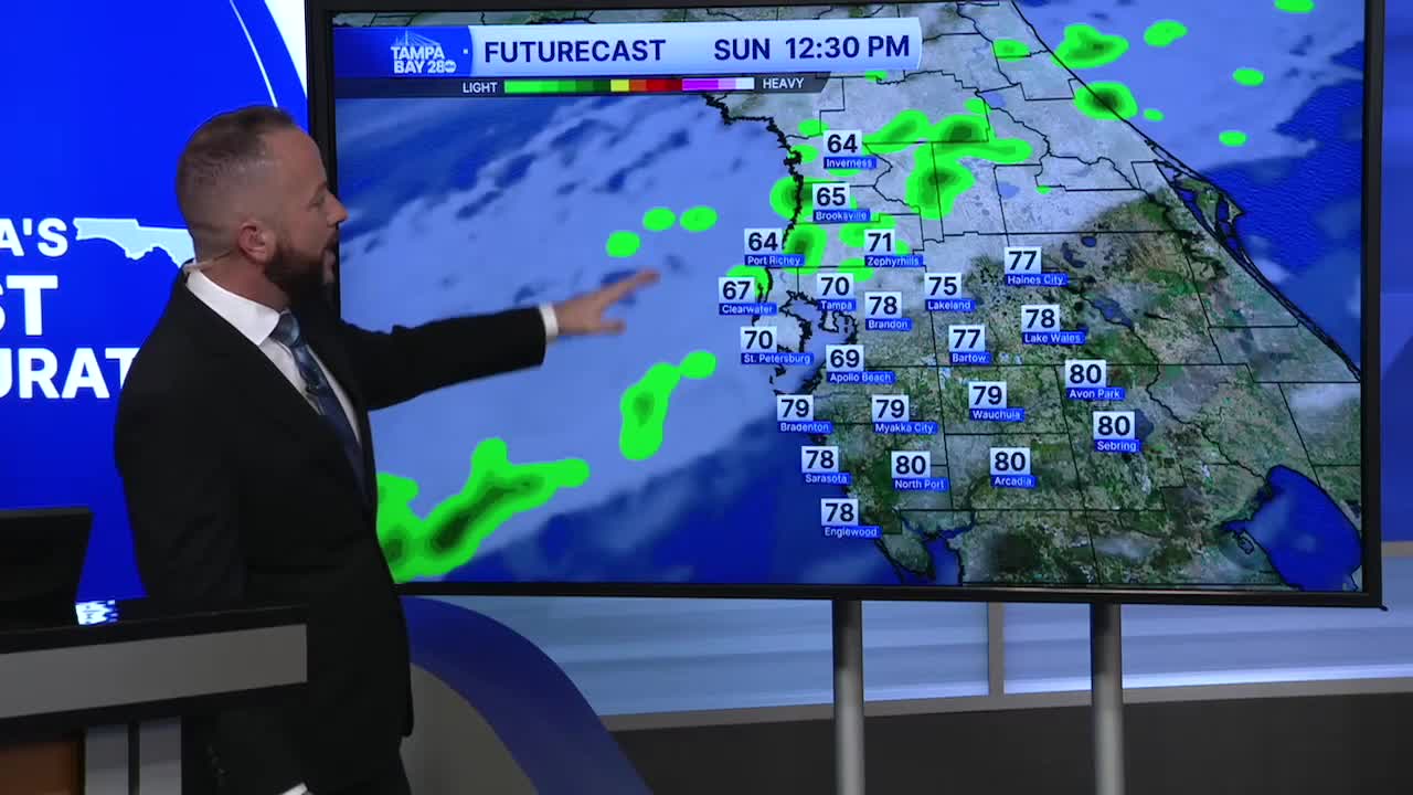


Expect a much different weather day Sunday compared to your Saturday. We'll see mostly cloudy skies after a little morning sun in our southern spots. A cold front will bring in the clouds with a few showers to the Nature Coast as early as 8 a.m.
The front will move south through the day, with cooler temperatures with it. Some spots will see their highs set in the early part of the day instead of the afternoon.
Nature Coast highs will top out in the morning in the 60s and stay there. I-4 highs will top out in the mid 70s but begin to drop around noon - 1 p.m. South of I-4, we'll top out around 80 by noon with temps closer to 70 by sunset.
Everyone see cooler morning temps for Monday with northern spots in the upper 30s and low 40s. The rest of us will see lows in the 40s.
Temps stay at or below average Monday and Tuesday. Another front arrives Wednesday into Thursday with a few more showers and another shot of cooler air for Friday.
