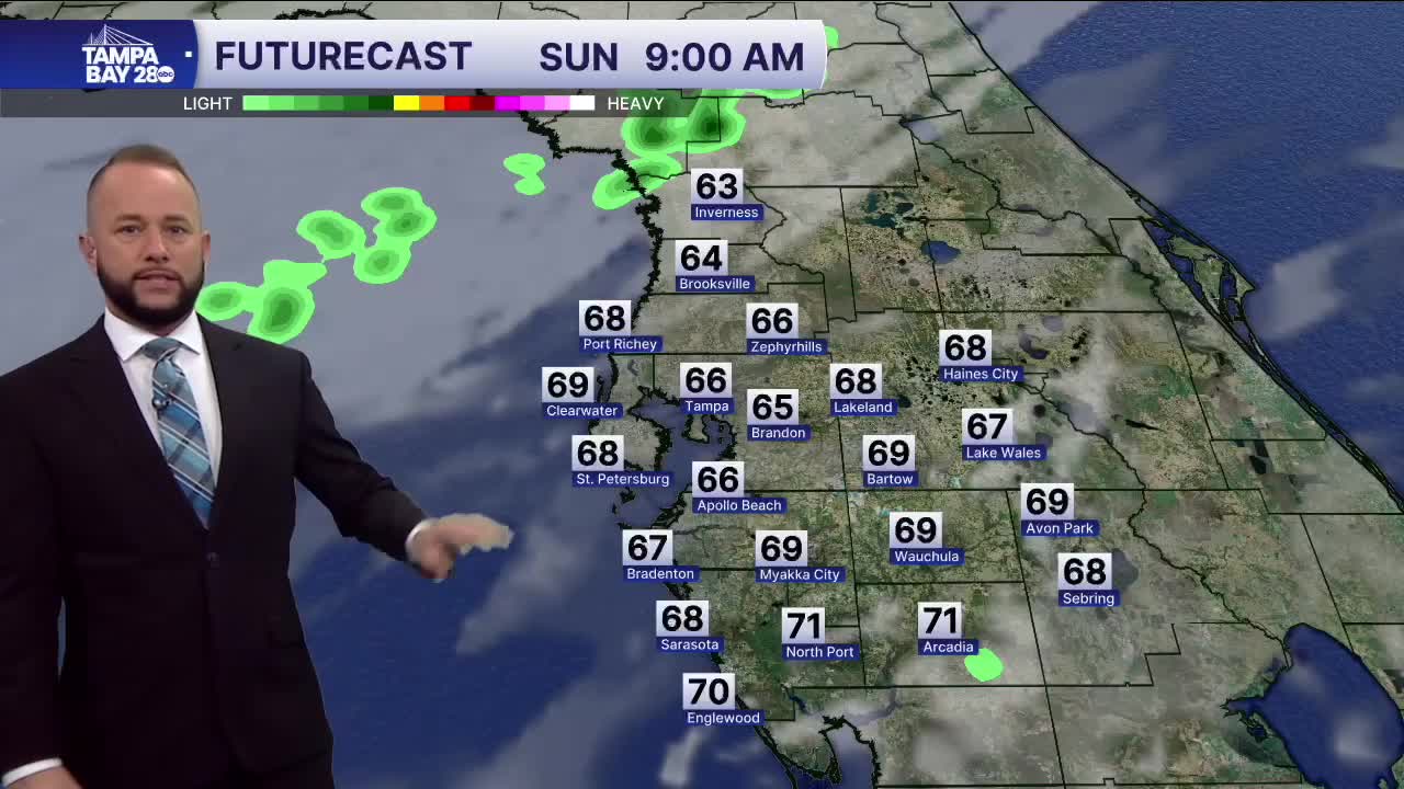


Expect today's cold front to bring a few scattered showers and much cooler weather over the next 24 hours. Highs today will be set earlier in the day, with the cooler air filtering in all afternoon.
Areas north of I-4 may not get to 70 before the front arrives while areas south of I-4 will top out near 80 before the front passes through.
Temps will be chilly tomorrow morning with many spots in the low 40s north of I-4 with mid to upper 40s south. Wind chills could dip into the 30s around 7 a.m. Monday morning so don't forget the coat!
