

Meteorologist Jason Adams has the latest ahead of overnight freezing temperatures:
Get ready, Tampa Bay! The coldest air in the last 16 years has arrived, and it will bring not only extremely cold temperatures but also a chance of snow flurries heading into Sunday morning.
Many of you have asked where the best place to see the chance of snow will be. In this type of setup, there isn't really one or two specific areas to scope. The best chance overall will be along the coast from Pasco Co south to Sarasota Co. This is where the NW wind will set up overnight into Sunday morning, and that will work to scoop up just enough moisture off the much warmer Gulf to give us a chance for flurries. Time-wise, it looks to be between 3 a.m. and 9 a.m.
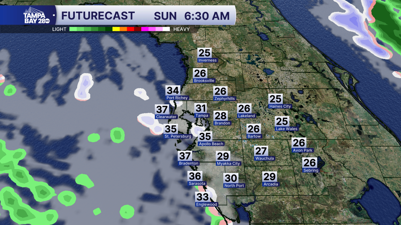
Gulf-effect rain and snow bands are highly unpredictable in their placement. We have a general understanding of the coastal areas listed above. Trust me, I wish I could tell you one specific location, but that's not how it works. I worked in Flint, Michigan, for two years, and the lake-effect snow from Lake Michigan was exactly the same. My house, 15" of snow, my tv station 10 miles north, 0" of snow. Crazy, right? Of course, we're not expecting accumulations here simply because the ground temperature is too warm, and any snowflakes that reach the ground will melt.
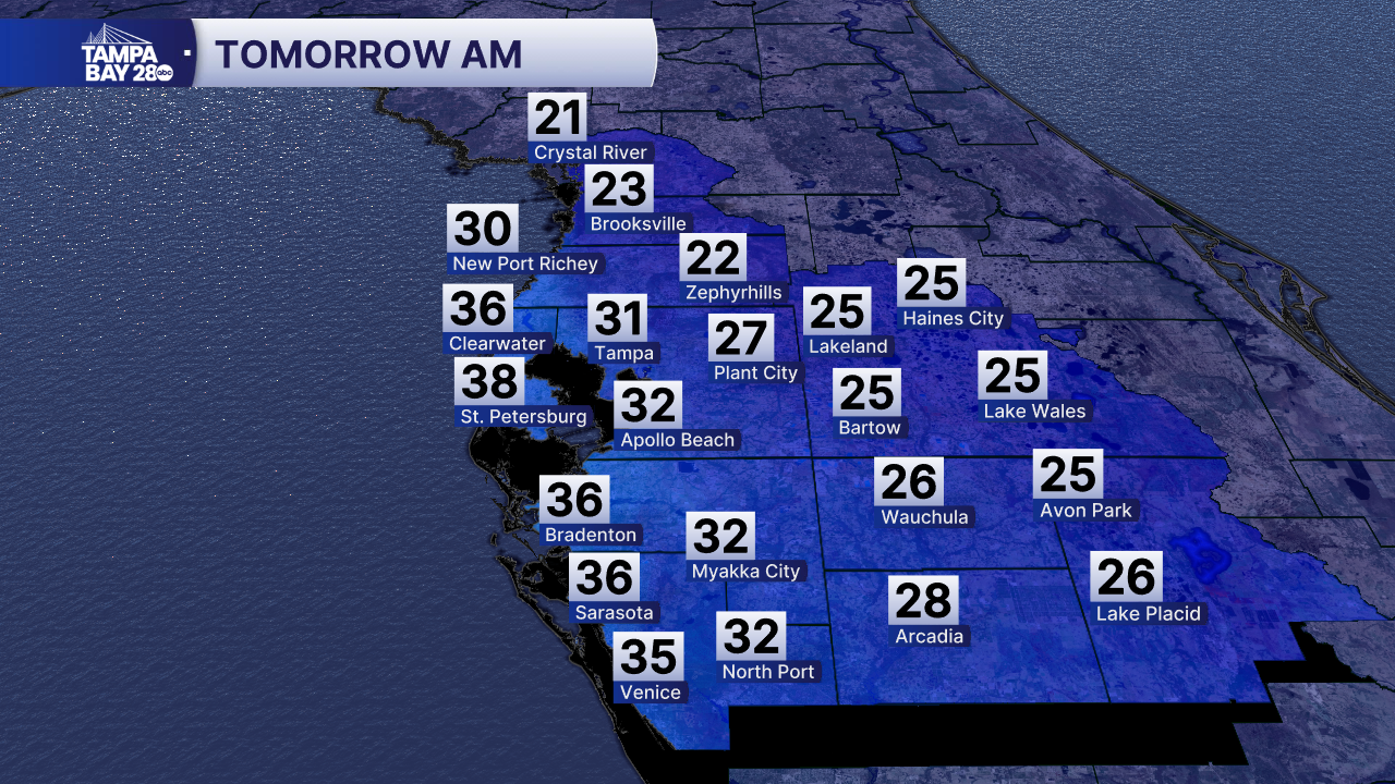
After any remaining flakes exit the area by around 9 a.m., we'll be freezing cold all day. Remember, a Freeze Warning is in effect for most of the area, and cold weather advisories are also in effect. Wind chills north of the area will be as low as 8°. Wind chills south will be as low as 21°.
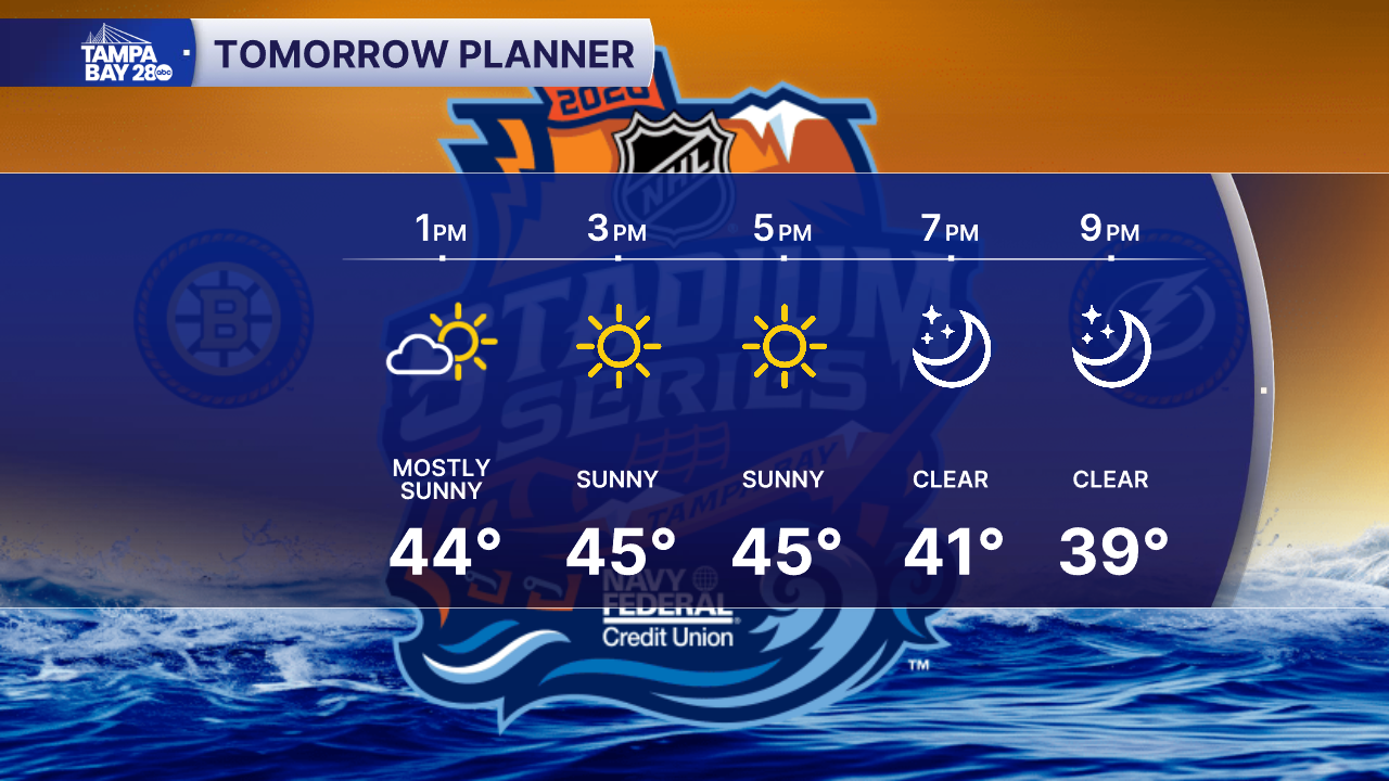
Temperatures only warm into the mid-40s for Sunday afternoon. For the Stadium Series game at Raymond James Stadium with our Tampa Bay Lightning, temperatures will drop back into the 30s as early as the 2nd period. Bundle up!
We'll likely have another freeze for many areas Sunday night into Monday morning.
