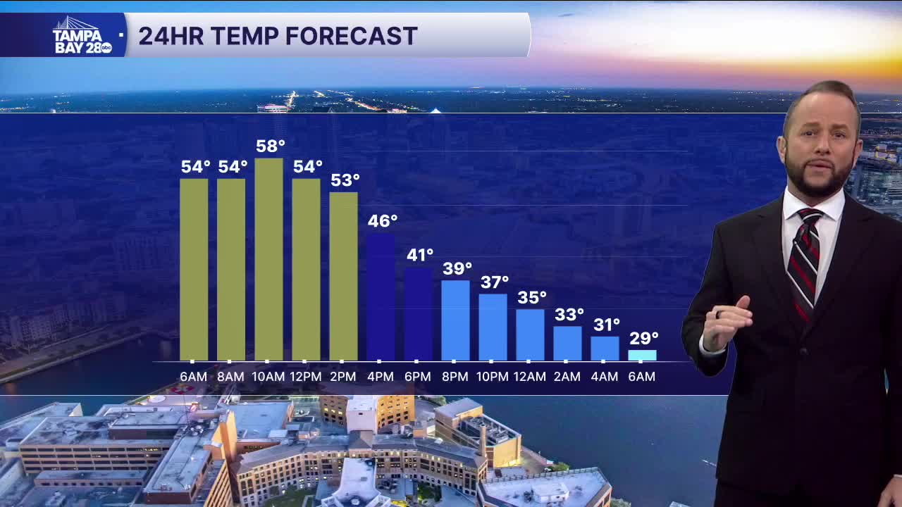


Get ready for a wild weather weekend here in Central Florida as a major storm system develops off the East Coast and drives a strong arctic front through Florida. Temps this morning will start in the mid to upper 50s with a few showers.
Winds will begin to pick up this afternoon as the front approaches. Gusts will likely exceed 30 mph through Gasparilla, with gusts even as high as 40-45 mph. Coastal gusts could exceed 45 mph. A Gale Warning is up for all of our coastal waters, which of course, includes Tampa Bay.
Isolated showers continue through the overnight with winds slowly winding down to 20 mph after midnight. A few showers could even mix with snow through 6 a.m. as we see the rare Gulf-effect snow phenomenon. No accumulation is expected but this will be the first time since 2010 that we've had a chance for snow!
Temps will fall well below freezing for most of the area. Low 20s are likely north of I-4. Along I-4, expect lows in the upper 20s to low 30s. Southern spots will drop into the low 30s. Coastal areas from Pinellas south will stay above freeze thanks to the Gulf waters. Wind chills will be as low as 8-14° north, with low 20s south.
The Bolts take on the Bruins Sunday afternoon at Ray Jay for the NHL Stadium Series! Temps will be COLD! We'll start with 30s around 9 a.m. for tailgating. Highs will only top out in the mid to upper 40s for the afternoon, with temps falling into the 30s after by the 3rd period.
Temps will drop to freezing or below again Monday morning.
