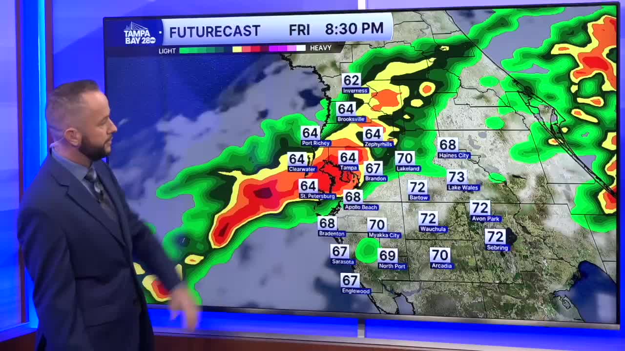


Another cold front is on the way, and it will bring a decent rain chance to most of the area tonight. The next several hours will likely be dry for most, but from rush hour through midnight, the rain chances are over 60%.
Some showers and pockets of heavy rain have already moved onshore for some of Pasco and Hernando counties. The rain out in the Gulf will build farther south between 4 and 8 p.m. The heaviest of the rain should be along and north of I-4, where some spots will get over 1/2 inch! There could even be some areas that see a few storms tonight, and that could boost rain totals in those areas over 1 inch.
The farther south you live, the lower the rain chance will be. Rain will still make it south of I-4, but the line of heavy rain looks to begin to weaken as we got from 10 p.m. on. Southern spots may only see a tenth to quarter of inch of rain. Here's hoping the weakening holds off a little while longer than currently forecast.
There could be a few lingering showers and storms Saturday, but the widespread risk will not be there. Just a few pop-up showers and storms with highs in the upper 70s.
