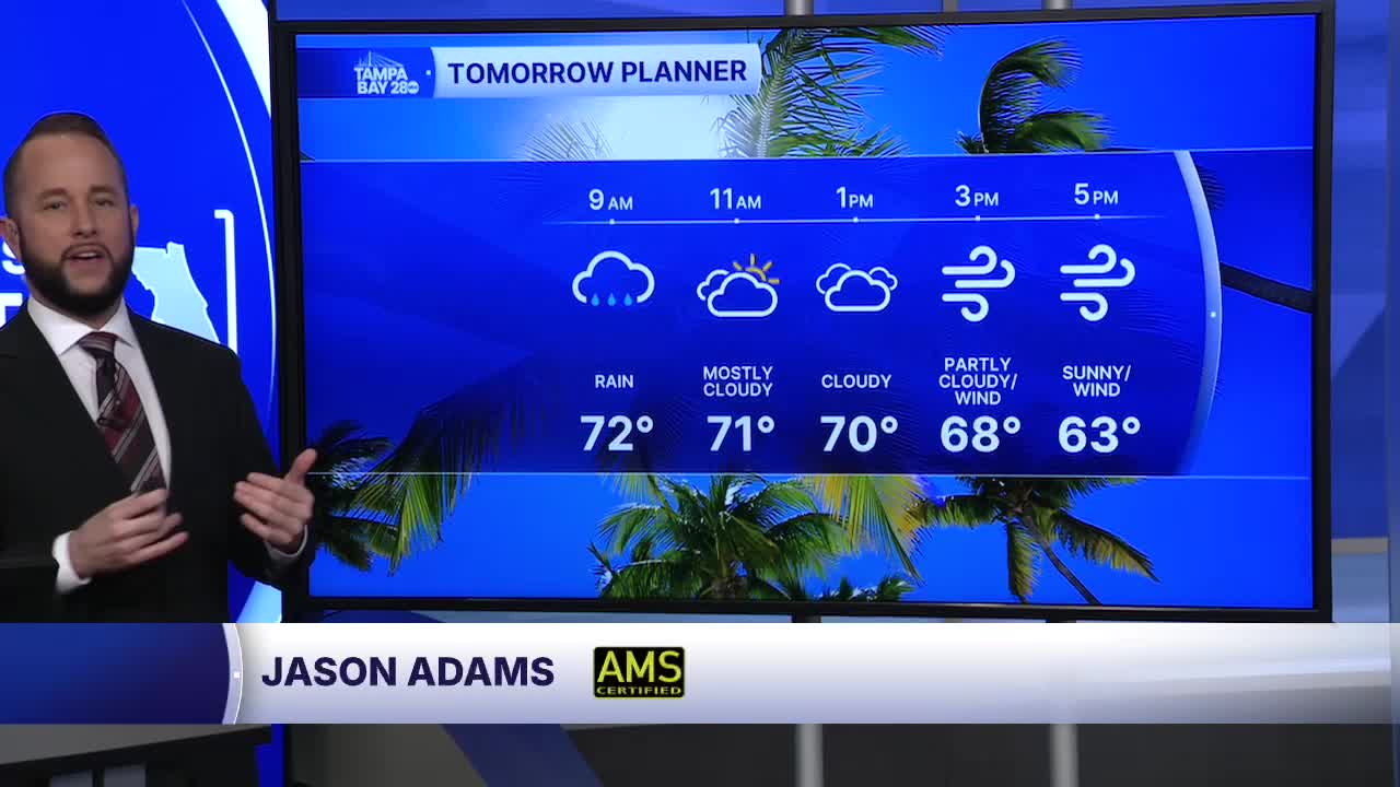


Our warm and sunny weather from the last few days is out of here Sunday. We'll start with patchy dense fog and a few morning showers and isolated downpours. That's the arctic front passing by your neighborhood. Temps will start in the low 70s in the morning and will fall into the 60s by the afternoon.
Winds will pickup from the northwest tomorrow afternoon as well. Gusts could exceed 35 mph at times, especially at the beach. The high winds, dropping humidity and extreme drought conditions will lead to a high fire danger Sunday and Monday.
Monday morning, we'll see temps drop into the 30s north with 40s south. Monday afternoon, we'll struggle to reach the mid 50s for highs!
Tuesday morning, lows will dip to near freezing north of I-4 and even some of our southern spots east of I-75 may see some patchy frost.
Our next warm up begins Wednesday afternoon and lasts through next weekend.
