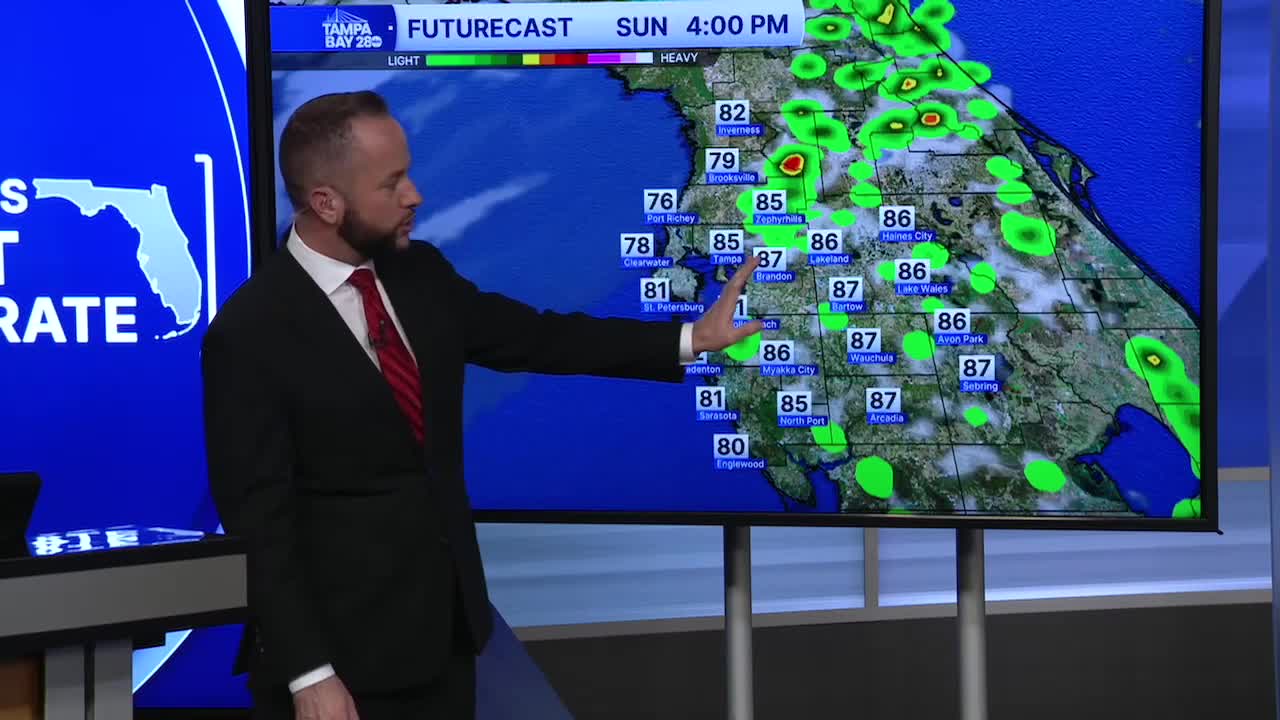


Expect another very warm day Sunday for March as highs climb back into the mid to upper 80s inland, with low to mid 80s at the coast. Temperatures continue to stay well above average for this time of year, and it looks to be that way through the next week.
We do have a cold front that will nudge the numbers down just a little by Thursday. Up until that point, more of the same is expected.
Rain chances will come down for the next few days as well. The summer-like pattern with sea breeze showers and storms will begin to wind down after Sunday. The bets rain risk Sunday will be inland as the sea breeze shifts inland through the afternoon.
Thursday, a cold front will bring a line of showers and storms with it, but it will only drop temps a few degrees as highs stay in the low 80s through next weekend. Humidity should take a nice tumble though, and that will allow morning lows to dip back into the 50s by Friday.
