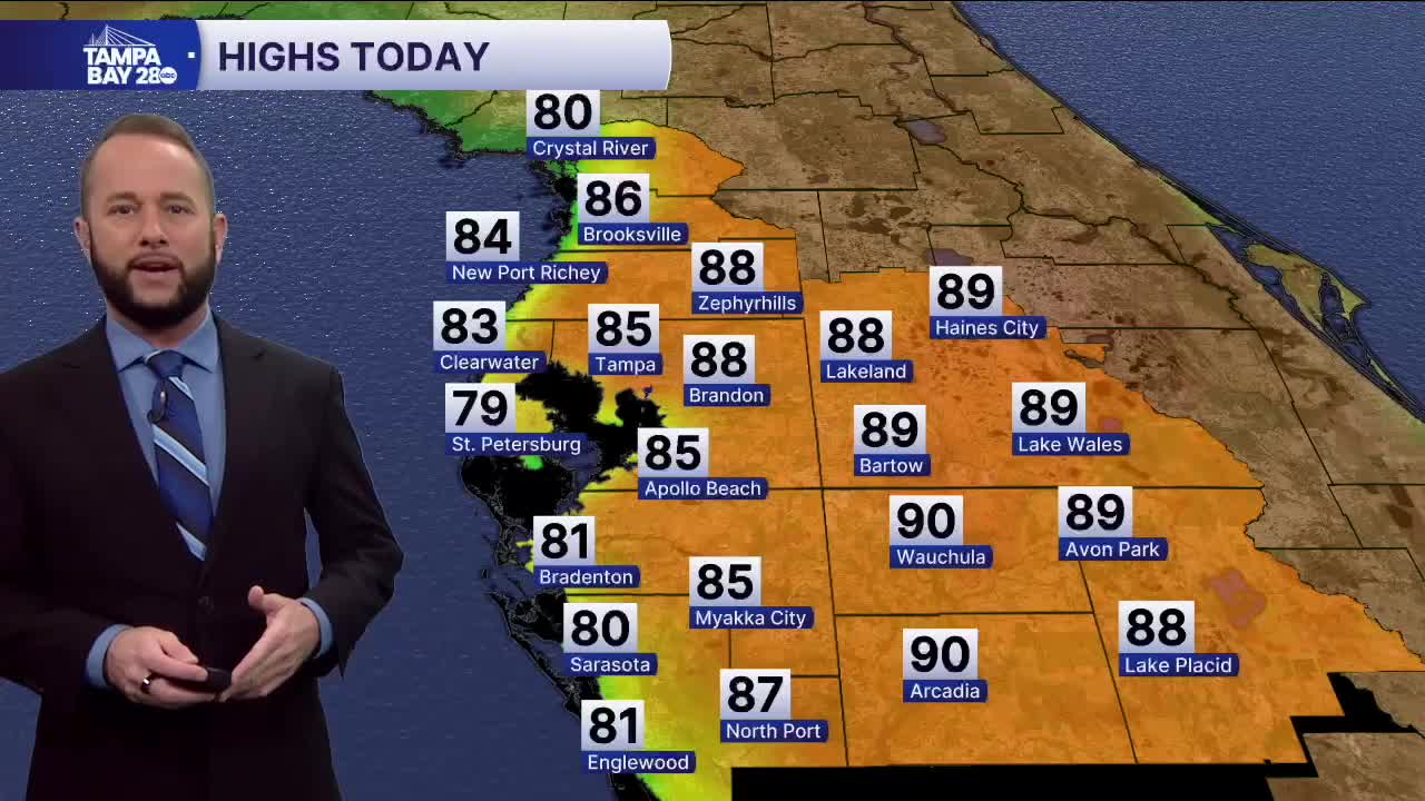


Expect another gorgeous day today with sunny skies and highs in the upper 70s on the beach, to low 80s a few miles inland. I-75 and areas east will actually reach the mid to upper 80s, with a few spots hitting 90! Our average high this time of year is 75!
Sunday, we'll see our next arctic front arrive, and it will bring winter temps back to the area beginning Monday. A few showers are likely along the front Sunday morning, but the front won't have a lot of moisture to work with. Some of the racers during the Gasparilla Distance Classic runs could see a few showers around 8 a.m.
The front will bring some gusty winds that will likely exceed 25 mph tomorrow afternoon. Then the cold air moves in Monday. Low temps will start in the 40s Monday morning with 30s north of I-4. Highs struggle to get past 55 for many of us Monday afternoon!
Tuesday and Wednesday morning will be the coldest mornings with frost and freeze conditions expected away from the coast. Warmer weather returns by Wednesday afternoon.
