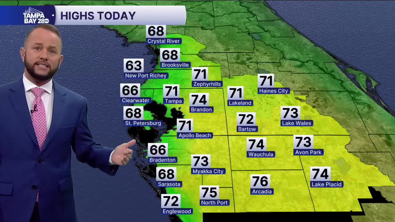


Expect a beauty today with sunny skies and highs in the 60s at the coast with 70s inland. Temps will be cooler at the coast for a few days over the next seven days since water temps dropped into the 50s with last week's cold snap.
Tonight, temps will be about 10-20° colder than they were this morning with many spots north of I-4 waking up to lows in the 30s with patchy frost. The rest of us will wake up to lows in the low 40s.
Sunday afternoon, expect sunny skies with highs back in the 60s at the coast with 70s inland. We'll do this same exact forecast Monday, but by Tuesday, our winds turn out of the east and that will work to start warming things up.
We'll see temperatures inland next week approaching 80 with mid 70s at the coast. Warm weather fans, your patience has paid off, ha! We're looking at temperatures trending to the warmer side over the next two weeks, with very brief shots of cooler air. The cold air that literally froze up last week doesn't show back up in the extended models for now. We'll keep you posted!
