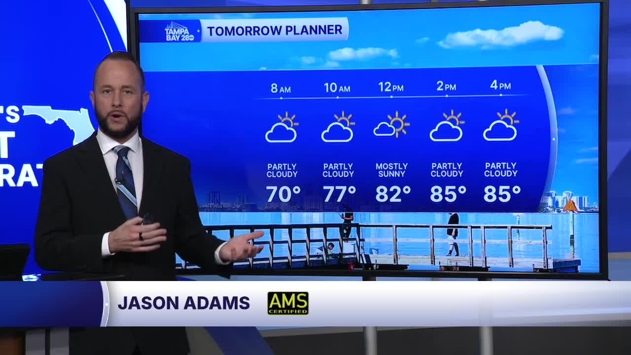


Expect a similar forecast Sunday with what we had today. Highs will top out in the low to mid 80s west of 75, with upper 80s to around 90 inland. Isolated showers and storms are possible inland but coverage will be pretty limited.
Monday, we have a weak cold front coming through. We call this one a "back door cold front" as it will be coming in from the northeast moving southwest, unlike our usual northwest to southeast moving fronts.
Don't get excited about a cool down though! Temperatures behind the front actually heat up. The front will shift the west wind this weekend to an east wind next week. That east wind direction heats things up for us here on Florida's West Coast.
Expect a few showers and t-storms with the front. Coverage will be around 20-30%. Temps will reach the upper 80s Monday, with upper 80s and lower 90s beginning Tuesday.
