


Our next cold front is on the way. It'll arrive tonight with a few showers and storms. Out ahead of the front, it'll be a breezy day with winds gusting over 35 mph at times. We'll see highs in the 70s along the coast with low to mid 80s inland.
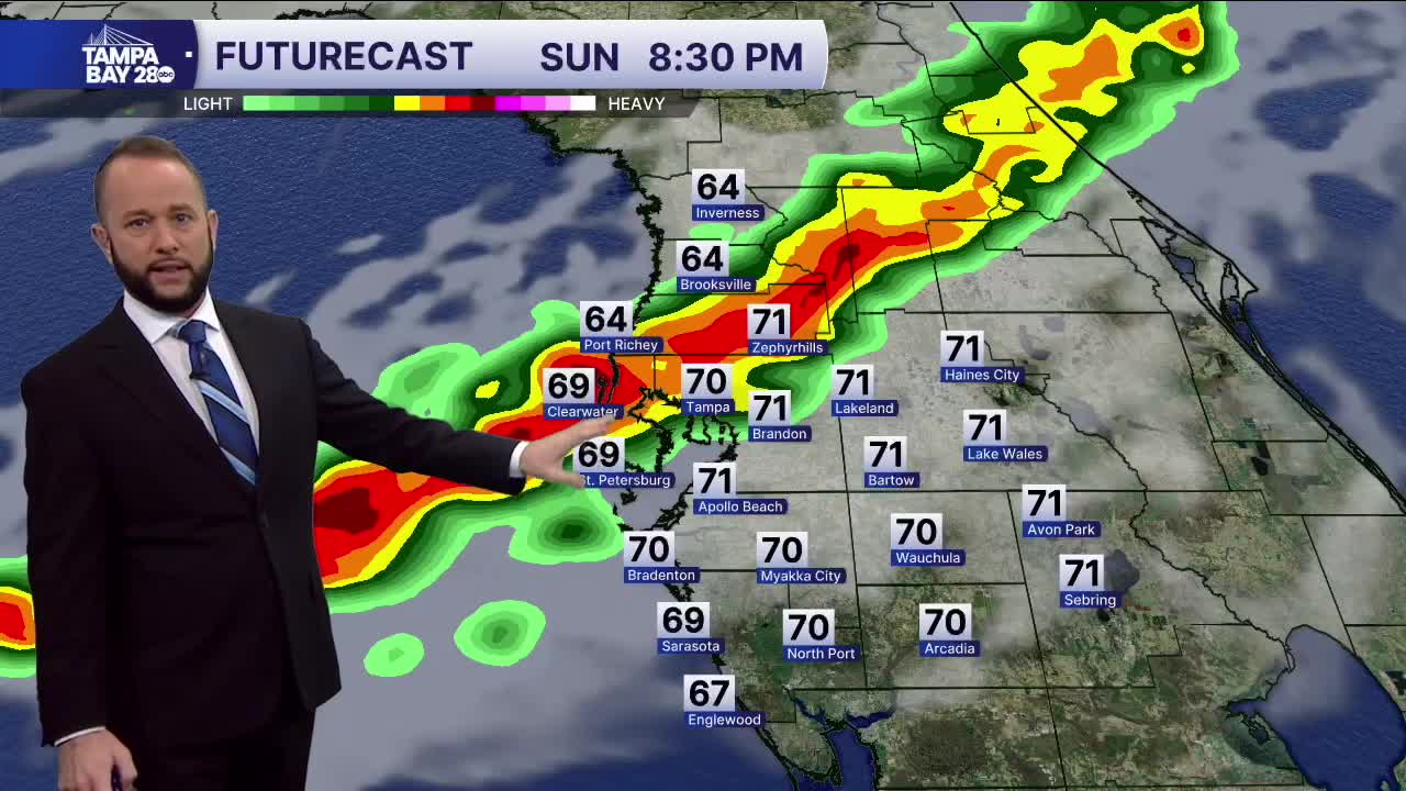
Rain chances begin to pick up after 4 p.m. The Nature Coast will see the rain first with the arrival between 4 and 7 p.m. Pinellas to Polk Co and along I-4 will see the rain arrival time between 5 and 9 p.m. South of Tampa Bay, the rain arrival time will be between 7 and 11 p.m.
Isolated severe storms are possible. We're under a level 1 & 2 out of 5 risk which is the lower risk, but we'll have to watch for a damaging wind gust or two as well as an isolated waterspout/tornado.
The front will clear the area overnight and bring a very small drop in temps for Presidents Day.
