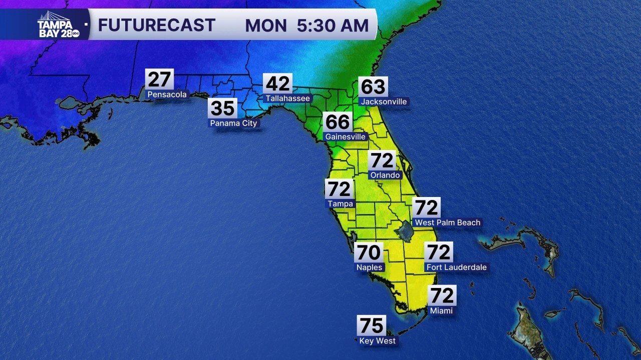


TAMPA, Fla. — Get ready for a major temperature drop, Tampa Bay! An arctic front is moving through tomorrow morning. Ahead of the front, we'll see our highs set by 8 a.m., in the low 70s. Behind the front, temps will drop into the 50s by 4 p.m., and continue to drop from there! The front will also bring a brief line of showers, which could include a few pockets of heavy rain. Check this out... at 5 a.m., it'll be 27° in Pensacola, while we're sitting at 72°!
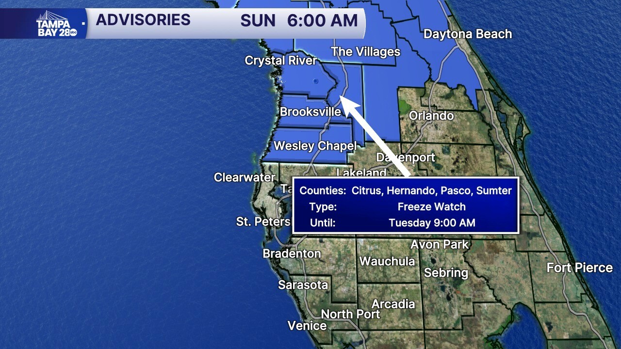
Temperatures fall all day Monday, and when you wake up Tuesday morning, a lot of us along and north of I-4 will be around the freezing mark. The NWS has issued a Freeze Watch for Tuesday morning for the Nature Coast, including Citrus, Hernando, and Pasco counties. Areas south of here may be included tomorrow. We'll let you know!
Wind chills will be as low as 22° in our northern spots. Southern spots, wind chills will drop as low as 28°! Tuesday afternoon, highs will only reach the 50s, which is where we usually see our low temps here at the end of January.
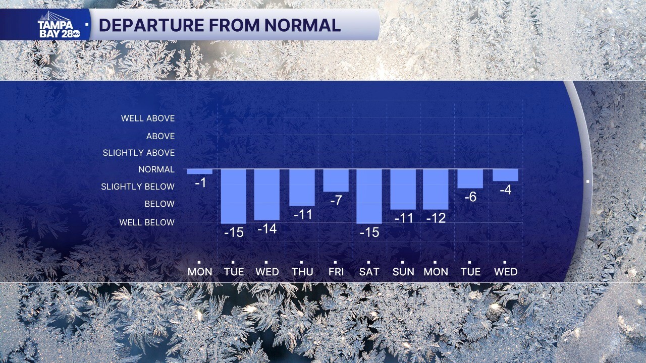
There's no major warm-up in the forecast through the next 10 days. This pattern is very unusual, as we normally see a cold spell last just a few days. This one will last for at least TEN days as several more arctic fronts reinforce the cold air. Gasparilla weekend looks pretty chilly, with highs in the 50s. There could be a few showers as well.
