


Hi everyone! I wanted to post an update on today's severe weather threat. This video was recorded at 2 p.m. I'll update more throughout the afternoon and evening.
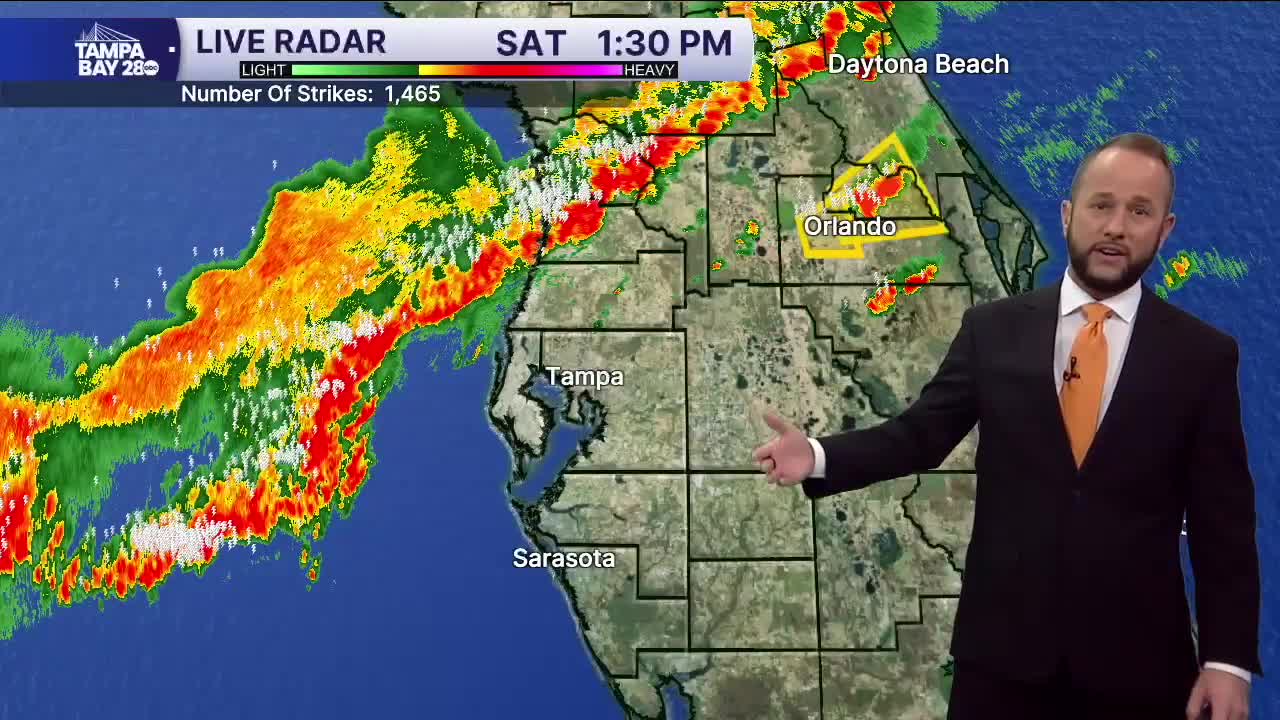
The line of storms is holding together much better than expected! That is fantastic news to help bring more areas some higher rain totals.
There is a tornado watch until 6 p.m. from Pinellas, Hillsborough and Polk counties north. Isolated waterspouts/tornadoes are possible but the risk continues to be low. Damaging wind gusts are also possible.
The storms are currently moving through the Nature Coast, with development south into the I-4 corridor by 4-5 p.m.
I'll have another update coming around 3:30 p.m.
