


Expect a better chance for showers and thunderstorms Sunday, with the highest coverage expected along and east of I-75. SW winds return tomorrow afternoon ahead of Monday's front, so the sea breeze shower and storm threat will shift inland between noon and 6 p.m.
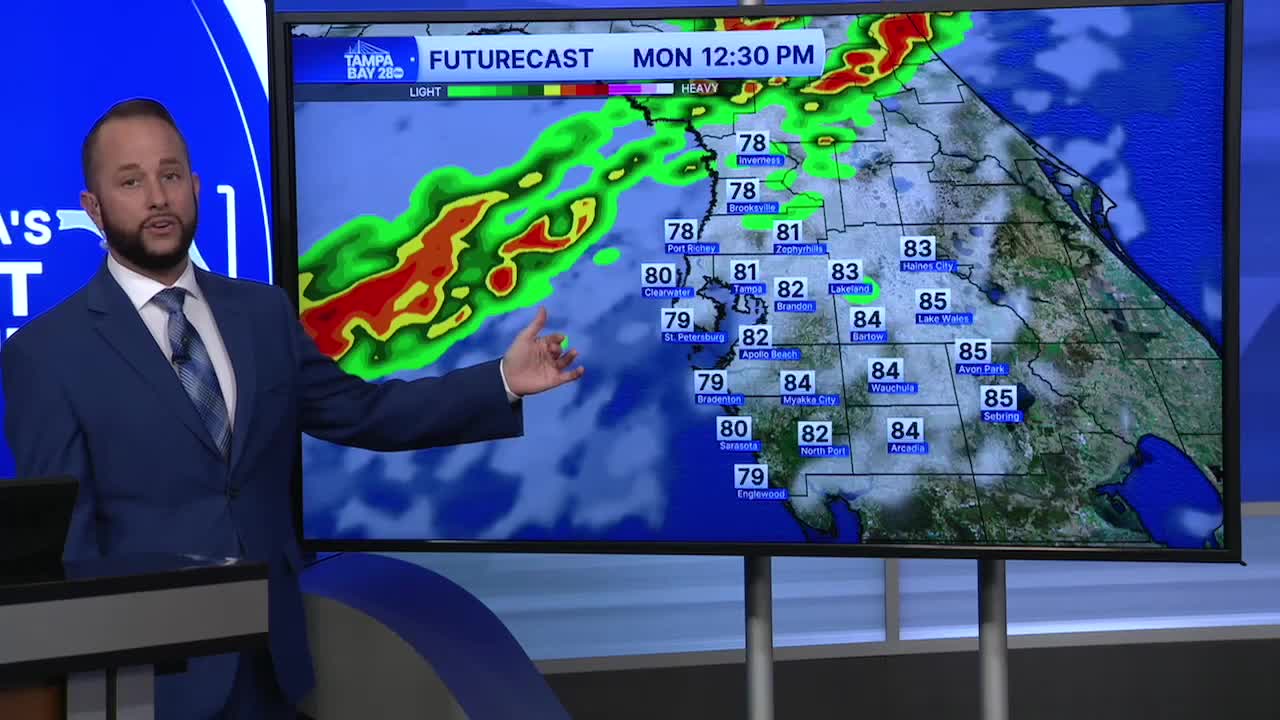
Monday, we'll all see a chance for rain as our next cold front moves in. Timing of Monday's rain chance is between noon and 8 p.m., with the noon start time north with most of this wrapping up by 8 p.m. down south.
That front will drop temperatures into the 40s when you wake up Tuesday. Afternoon highs will struggle to get past 60 for much of the area. Every day so far this month, our highs have been above average. That will change Tuesday and Wednesday.
Wednesday morning will be the coldest with a few northern spots dropping below 40. The rest of us will drop into the 40s. Good news with all this cold coming... a frost and freeze is NOT expected.
Temps begin to warm up quickly from Wednesday afternoon on. The rest of our local spring break will be warmer with highs in the upper 70s starting Thursday.
