


A cold front has moved through the area. This front won't bring in any cooler air, but there will be some changes behind it that we all need to pay close attention to.
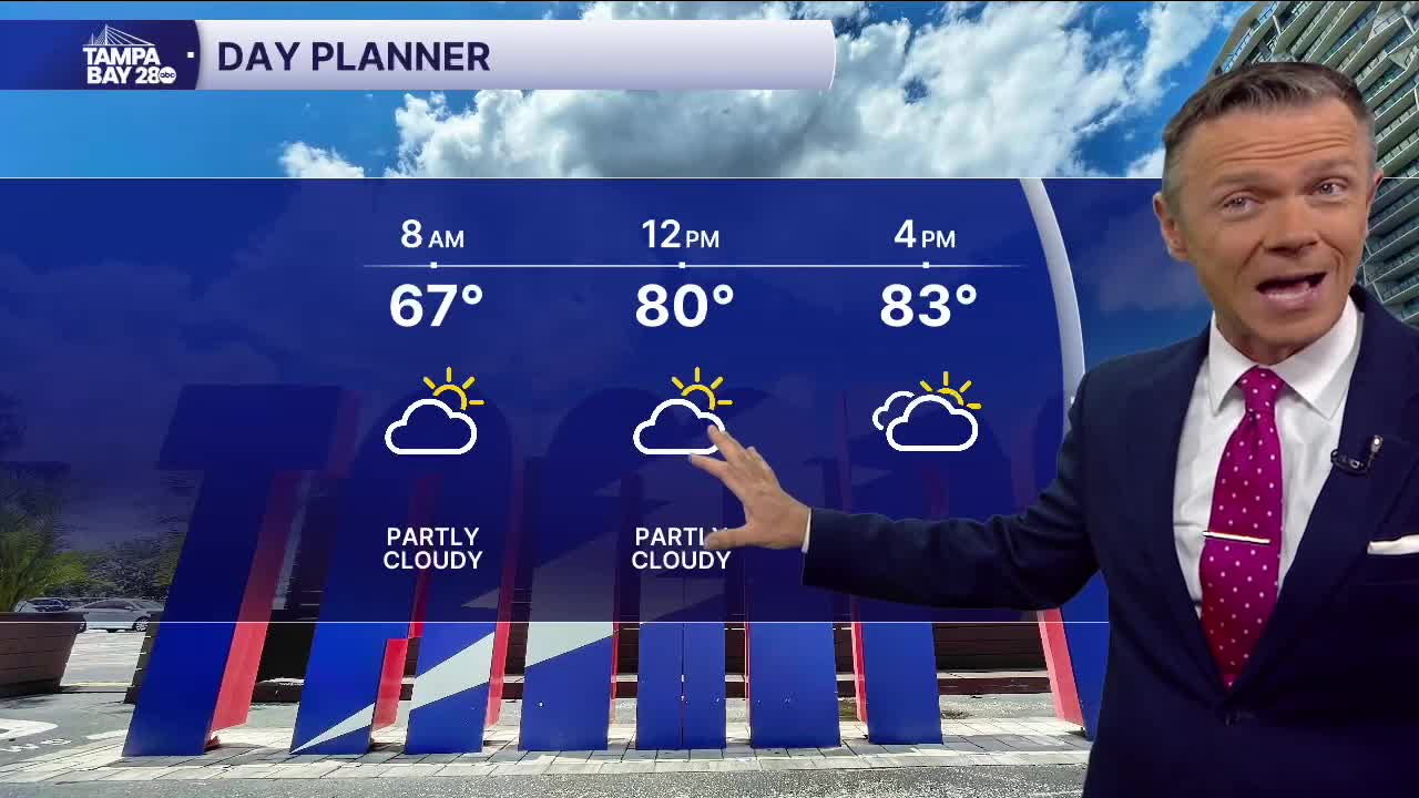
Today you'll notice the wind. It'll be gusty from the northeast. That northeast breeze will bring in much drier air with dew points falling into the 30s and 40s across the region. Highs will still reach into the 80s with periods of clouds from time to time.
The drier air will mean cooler temperatures overnight. Many north of I-4 and away from the coast, farther south, will see their temperatures fall into the 50s Tuesday morning. Upper 40s are possible in Citrus County.
The drier air combined with sunny skies and continued gusty winds on Tuesday will mean elevated fire dangers on Tuesday afternoon. A fire weather watch has been issued for all of central Florida for Tuesday. Please be VERY careful. There should be no outdoor burning today and Tuesday.
Humidity levels will slowly increase on Wednesday and Thursday. By Thursday, a few scattered pop-up showers are possible, though they won't add up to much.
The weekend looks moderately humid and warm with highs in the upper 80s to around 90 both weekend days.
