


This morning may have been warm and humid but as the rain moves south through the rest of the day, the clouds will clear as well.
This will be happening as winds increase from the west and northwest, dropping our humidity and our temperatures. By the time you commute home tonight, you'll be experiencing strong winds and temperatures in the upper 50s.
Overnight, the winds will remain gusty, allowing temperatures to drop into the 30s across most of the area, and into the mid-20s in our northern counties away from the coast.
Although winds will relax some by the morning, even a little wind will make it feel much colder. Wind chills will easily feel anywhere from the teens to the upper 20s.
A freeze is likely north of the Bay on Tuesday morning with 20s and 30s common across Citrus, Hernando, and Pasco counties.
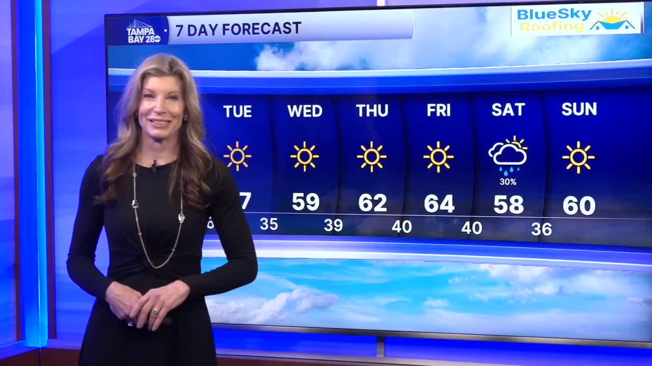
A freeze watch has been issued for inland Hillsborough and all of Polk County for Tuesday night into Wednesday morning. Highs on Tuesday will only reach the mid-50s, allowing for Wednesday morning to be even colder.
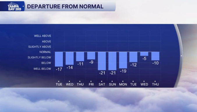
Temperatures will stay below where they should be through the rest of the week. This weekend, we'll be watching for yet another coastal storm to develop east of Florida. This could bring some rain our way for Saturday morning, followed by more cold air. In fact, the Gasparilla parade may be unusually cold, with some of the data suggesting it could be the coldest Gasparilla in recent memory.
The cold weather will stick around for the Stadium Series game at Ray J on Sunday evening.
Stay warm!
