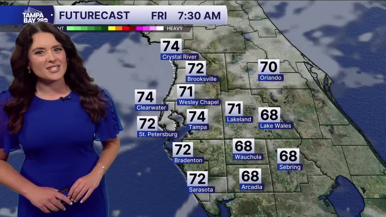


TAMPA, Fla. — Good Friday morning, Tampa Bay! It is a mild morning with mostly cloudy skies and temperatures in the 60s and 70s.
The clouds will recede throughout the day as highs ride back again to near 90 degrees in the interior, mid to upper 80s in Tampa.
The weekend brings our next best chance of rain as a cold front approaches from the west.
It will be warm and muggy with most starting in the 70s and topping out at almost 90 degrees. Winds will pick up ahead of the front, and we could see gusts on Saturday afternoon at 30 mph.
The front looks to bring some good rain and storms to Citrus County first around the early afternoon. Around Tampa, closer to sunset and south of Tampa into the evening and overnight.
The Storm Prediction Center has put us under a level 2/5 risk for strong to severe storms for those north of Tampa and south of I-4 under a level 1/5 risk for Saturday.
Damaging winds are the main threat, but the front looks to lose a lot of steam as it approaches.
Some lingering showers south of Tampa are possible on Sunday, but the majority of us will dry out. Temps fall to near 80 degrees. Next week dries out with the near 90-degree heat returning.
I hope you all have a great day and an even better weekend!
