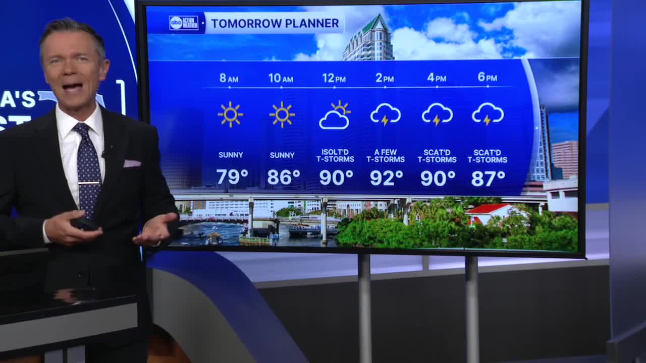


Expect temperatures to start in the mid & upper 70s on Monday morning. Although there will be a few clouds, it will be a dry start to the day. That dry weather will likely last through the morning. By the afternoon, highs will reach into the low 90s, close to where they should be for this time in August. We'll also see sct'd pop-up storms with the coverage generally around 40-60%.
Look for hotter temps & lower rain coverage Tue-Thu this week. Highs will be in the mid-90s & rain chances will hover only around 20-30% each day. This is due to a north flow above us, on the western circulation around Erin, which will drop moisture levels across Florida.
Rain coverage will return to more typical levels by the end of the week & the weekend as we begin to turn our attention to the next system in the Atlantic.
TROPICS: Erin will be moving through the open Atlantic off the east coast all week. The storm will bring some gusty winds to the coast. But the biggest threat to the US will be from large swells which may be over 20' high near the coast & lead to coastal flooding, beach erosion & dangerous rip currents from the Florida east coast all the way north to Atlantic Canada.
Another tropical wave follows Erin. This one may begin to get better organized by the end of the week, well east of the Leeward Islands. It is currently not a concern.
