


Freeze and cold weather advisories have been issued for our area for Friday morning.
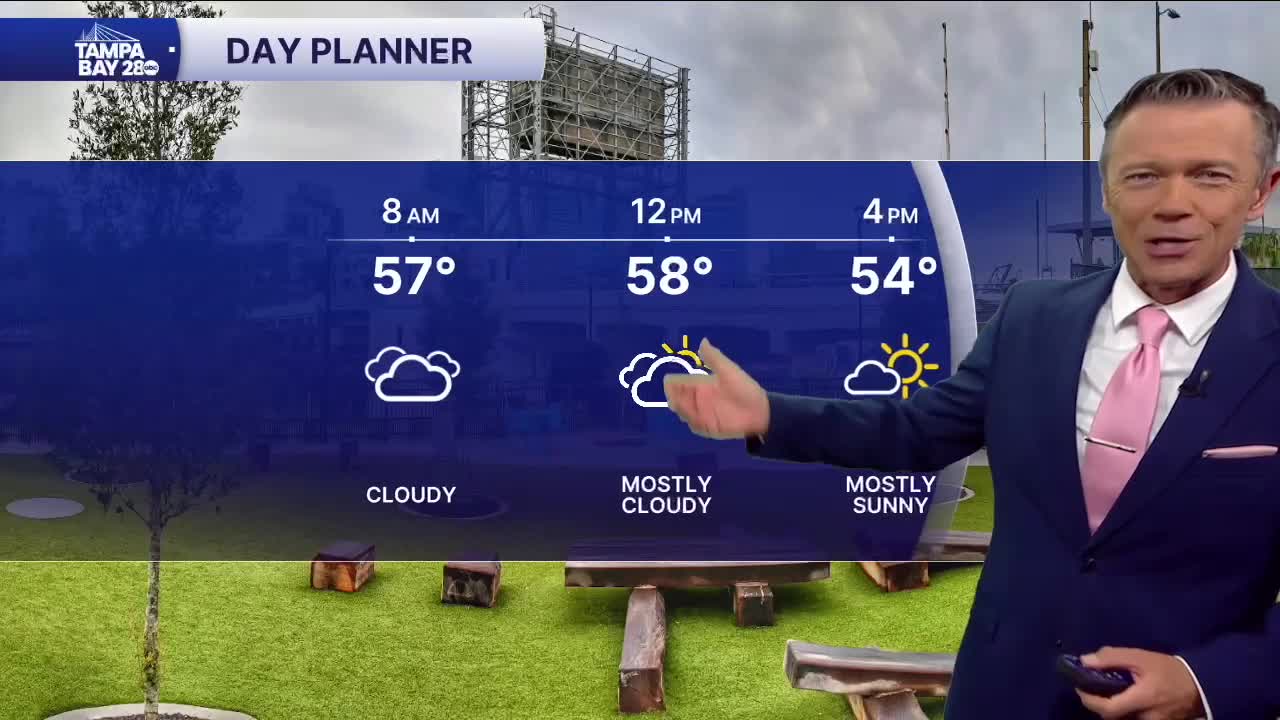
Following some morning showers, we'll see skies clear this afternoon and temperatures will remain chilly in the 50s. You'll need a jacket all day and bring a heavier coat if you have any kind of outdoor plans for this evening.
Friday morning will be one of the coldest we've seen in some time. Many north of the Bay and east of the coast, farther south, will wake up to temperatures that are below freezing. Citrus and Hernando counties will see temperatures as low as 24F. Farther south, most are likely to fall to the 28-32F range.
There will be wind around on Friday morning, which will make it feel much colder at times. Wind chills may dip into the low 20s for some at times. Friday afternoon will be sunny and chilly with highs only around 60F.
Saturday looks a little milder, but that's mainly because we'll already be tracking our next approaching front. This front will bring a chance of showers late Saturday into Sunday morning. Behind the front, another round of cold weather is likely. More freezing temperatures are possible for some on Monday morning.
The start of next week looks cool but there are signs that point to warmer weather by the end of next week.
