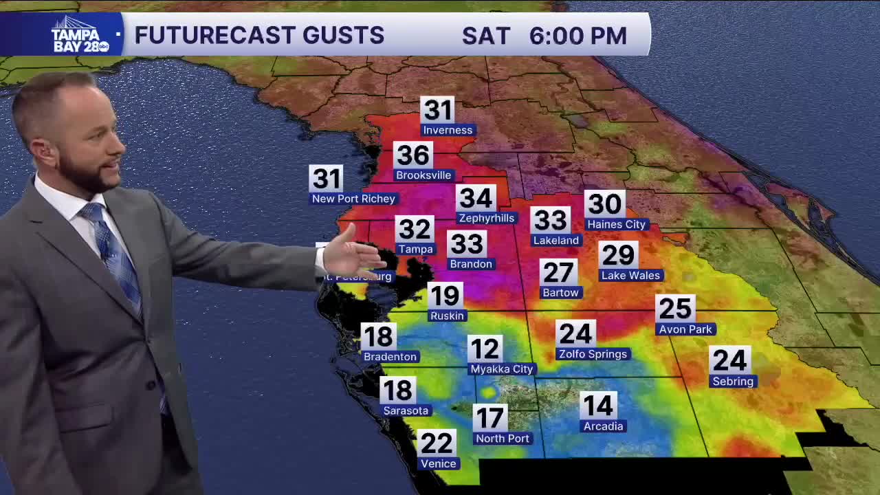


Expect a decent Saturday forecast with mostly sunny skies and highs in the mid to upper 80s. However, later today, a strong cold front will move in, and it will bring gusty winds over 30 mph after 3 p.m. So if you had any plans outside, be prepared for the gusty winds to pick up once the front passes by.
Timing of the gusty winds arrival: Nature Coast 2-4 p.m. I-4 Corridor 3-6 p.m. South of I-4 4-7 p.m.
This front will also bring a slight shower and storm chance, but rain chances are pretty low. The gusty winds continue Sunday but will be out of the east and that will bring a few showers and storms off the Atlantic, with the best chance inland.
Highs Sunday will be a little lower, in the low to mid 80s.
Next week, outside of an isolated shower and storm, temperatures will be the weather story with highs staying in the mid to upper 80s.
