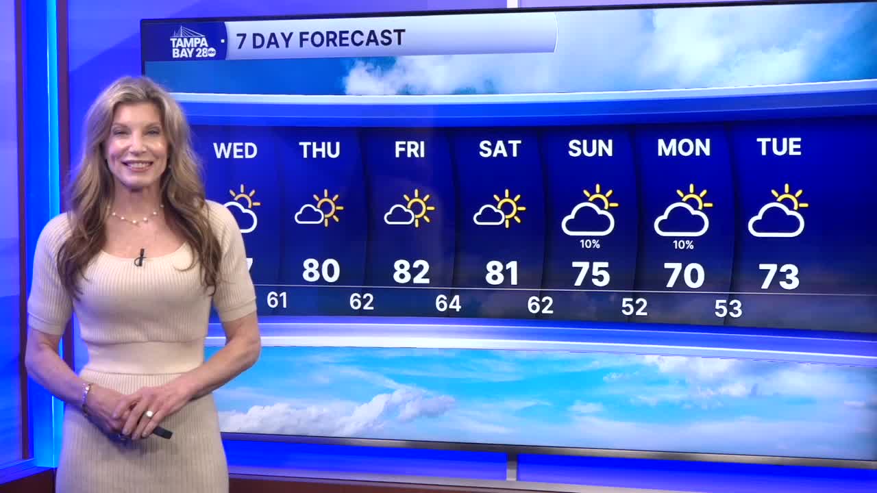


Another round of fog is likely tonight into Thursday morning. It may linger along the coast and offshore through mid to late morning, but our roadways should clear by the end of the morning rush. Lows will be in the mid-50s to mid-60s.
Warmer temps over the next few afternoons as we see more sunshine and less fog. Highs could get into the low 80s at the start of the weekend before our next cold front.
Very low chances of rain and low rain coverage on Sunday as the front pushes south. I wouldn't change your weekend plans over the minimal chance of rain. Highs will still be in the mid-70s Sunday, but cooler air moves in overnight.
Monday morning lows will be chilly- most of the area in the 40s! Highs will struggle to hit 70 to kick off the week.
