


More scattered storms return today.
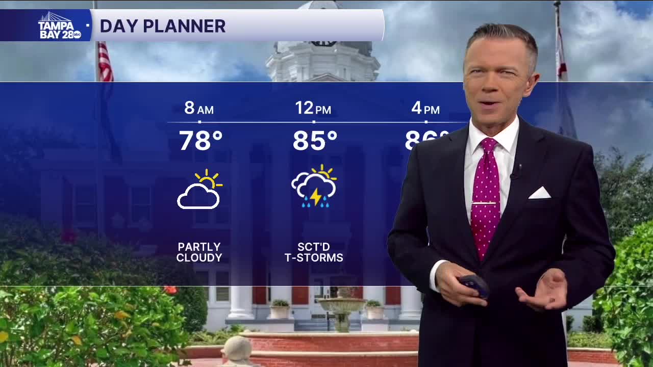
No rain is expected for the morning hours today. Temperatures in the early 70s will warm into the 80s as we go into midday.
It's around midday that the scattered rain and storms will begin to develop. This will be our last day with a wind flow from the south. That will mean storms likely firing up somewhere in the Highway 19 corridor late morning and early afternoon. These will then slowly transition toward the I-75 corridor over the course of the afternoon. Look for the heaviest rains to again fall between Tampa and Lakeland later today.
Beginning Friday and lasting into the weekend, a west-to-east pattern will set up for the rain. This usually means warmer mornings along the coast, with temperatures starting near 80 degrees. There may be a few quick downpours in the morning along the coast. Most of the rain, however, will happen east of the coast on these days.
Anyone heading to Orlando this weekend should expect scattered PM and evening storms each day. Some of these will be very heavy. Highs will stay around 90, cooling into the 70s and 80s in places that see some afternoon rain.
