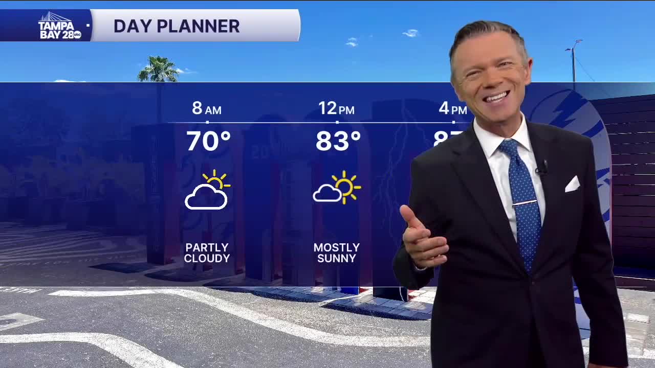


Another comfortable start on this Wednesday with most towns starting in the 60s, with those west of I-275 a bit milder in the low 70s.
We'll see sunny skies today and highs in the 80s along the coast, thanks to a sea breeze that will move in during the afternoon. East of I-75, the sea breeze is not likely to have much of an impact, so expect warmer temps there, in the low 90s.
Mostly sunny and dry weather will return on Thursday with just a few scattered clouds moving by during the afternoon.
Friday will be more humid and warm. There will be a very slight chance of a pop-up shower at just about any time during the day on Friday, though the rain chances are only around 10%.
Some of the latest data today indicates that the weekend storm system may move through late Saturday into early Sunday instead of all on Sunday. This will have a couple of impacts:
1. Rain may impact those along the coast on Saturday evening. Anytime after 6 p.m. Saturday, west of I-75, those along the coast will have to factor rain chances into any outdoor plans.
2. With the system moving mainly after dark, it's likely to be weaker. This could mean less widespread and more scattered rainfall.
The front will likely briefly slow down on Sunday, just south of the I-4 corridor, keeping clouds and showers around through at least the first half of Sunday.
I'll keep you updated on the progress of this system.
