


Drier air starts to move in today.
We're looking at another comfortable start across the area this morning with drier air all the way down to the I-4 corridor. South of I-4 the humidity increases quickly and there is even a little bit of light rain.
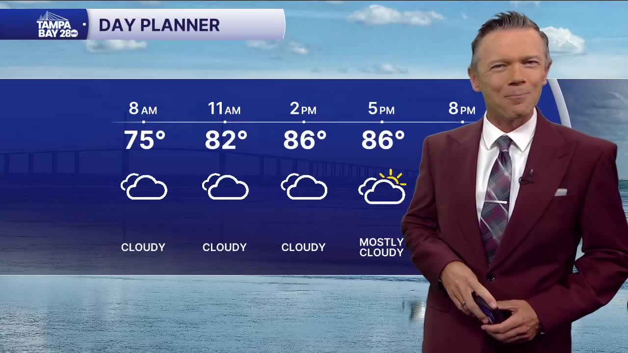
Drier air will prevail for most today with highs in the upper 80s and low 90s. There will be more clouds than sun at times. A few pop-up showers are possible across central Florida late today with the majority of these developing east of I-75 this afternoon and evening.
Look for drier and more comfy air to really take over in the mornings this weekend. Temperatures will fall to the 60s for many both on Saturday and Sunday morning so get up early to take advantage of the nicer weather. The afternoons will still be very warm with highs near 90 and a few (20%) pop-up afternoon showers.
The nicer weather looks to last through at least Tuesday of next week. Rain chances and humidity levels will likely increase by Wednesday or Thursday.
TROPICS: There is now a 40% chance that a tropical wave in the Atlantic will develop next week as it moves east. There is nothing to worry about for us with this system right now.
