


Morning rain, then slow clearing as winds pick up today.
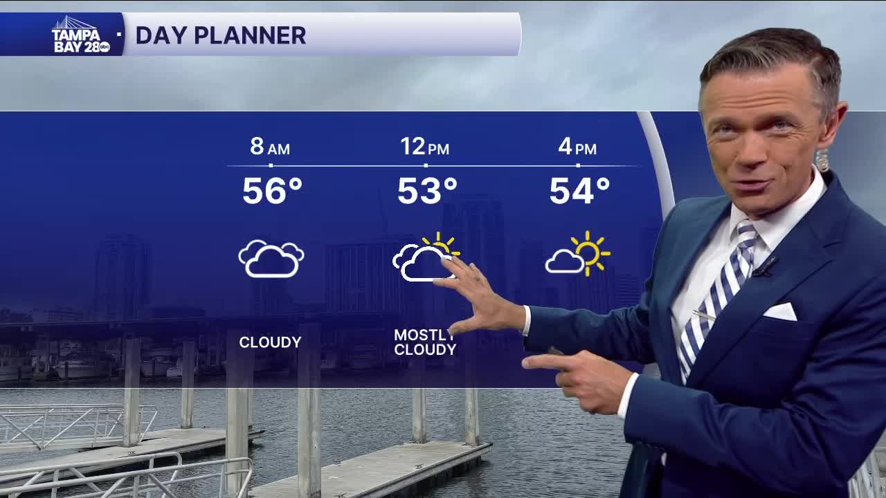
The rain will only impact us early today, with most along the coast clearing out of it by 7 a.m. and those east of I-75 by 9 a.m. at the latest. Clouds will hang around behind the showers for a few hours before eventually clearing during the afternoon. Meanwhile, winds will be increasing from the NW with some gusts over 30 mph possible. With temperatures holding in the 50s, that means it'll feel quite chilly at times. Bring a windproof jacket with you today; leave the umbrella at home.
Cold weather returns overnight, but this is NOT like what we just went through. Think of a more typical cold front, which is less intense and lasts a much shorter period of time.
This means temperatures in the 30s for most Friday mornings, but also above freezing in most places except interior Citrus County, where a freeze warning is already posted. For the rest of the area, cold weather advisories have been issued away from the coast. This is for wind chills below 32F, but not temperatures.
Friday afternoon will already feel better with most towns reaching the low 60s under mostly sunny skies.
Milder temperatures are likely this weekend. Highs will warm into the upper 60s on Saturday and the low 70s on Sunday with continued warm, sunny weather for most of next week. Mornings will be chilly in the 40s and 50s, but afternoons will warm into the 70s.
