


TAMPA, Fla. — Good Friday morning, Tampa Bay! The forecast today looks very similar to yesterday, but the rain chance is more isolated with slightly less heavy downpours. Most of us wake up in the upper 60s and low 70s with some patchy fog inland.
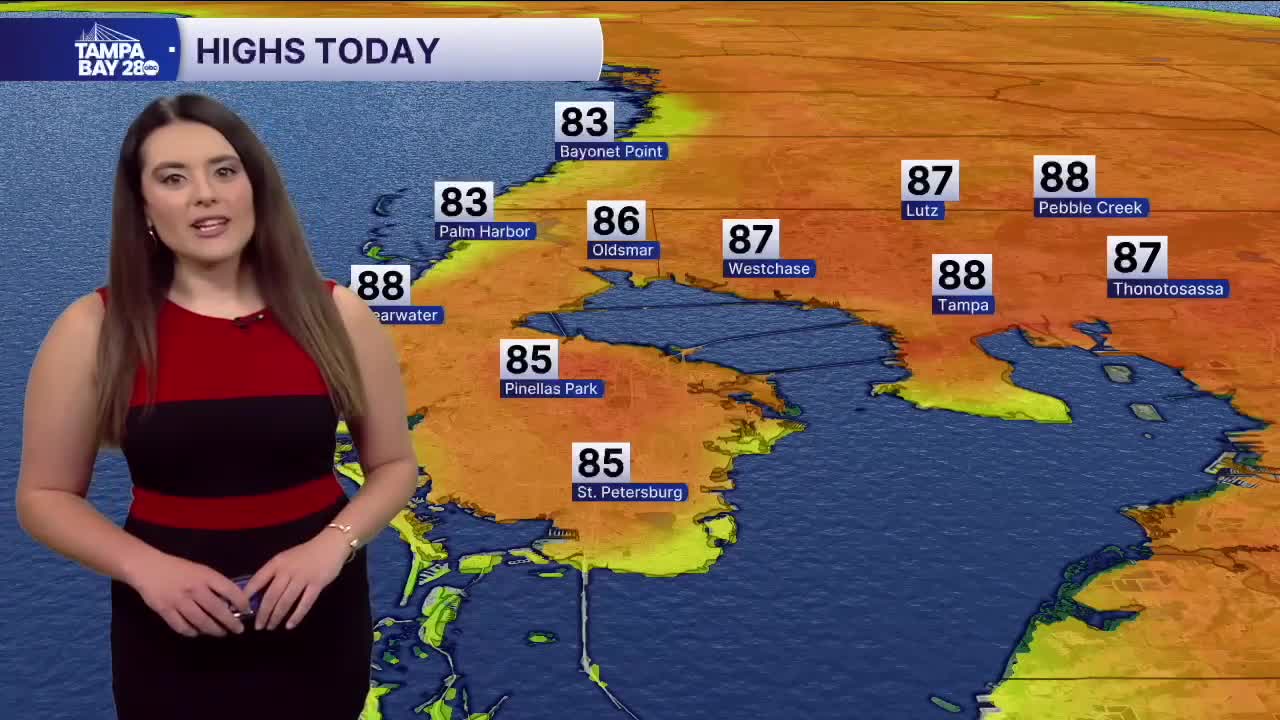
The fog fades quickly and sunshine takes over! Highs surge into the mid to upper 80s, potentially challenging the record. There is an isolated chance for showers and a few rumbles of thunder in the afternoon, but not as widespread as yesterday. By 8 p.m., most are gone.
The weekend looks hot with highs in the mid to upper 80s and mostly sunny skies. A chance for an isolated shower is possible on Saturday, with skies trending drier on Thursday. Next week looks mostly dry with less support of isolated showers in the afternoon. Highs stay well above normal. Another cold front looks to sweep through late-week, dropping temps a tad with a chance of rain.
I hope you all have a great weekend!
