


Showers likely this afternoon.
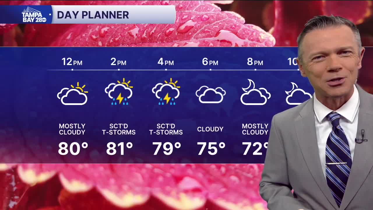
If you need dry weather for any activities or errands today, be sure to complete those before 1pm today. We'll see a dry morning and midday. During the afternoon, a front will bring the chance for sct'd showers and maybe even a thunderstorm. Highs will reach into the 80s before the rain arrives. You'll also notice a stronger southwest breeze.
The front will bring dry weather for the start of Friday. During Friday afternoon, however, the front will start to lift back north. This will bring a chance of some pop-up showers south of I-4 on Friday afternoon.
The sct'd pop-up showers will continue through the weekend. Saturday most of the rain will again be south of I-4 with coverage up to around 40% increasing to 60% on Sunday. The rain will be similar in character to what we see in the summer, with the downpours popping up randomly.
Monday's higher rain chances are due to a stronger cold front. This front will likely bring a round of heavier rain our way and then still looking at the chance of cooler weather for Tue through Thu AM of next wee,
Have a good Thursday!
