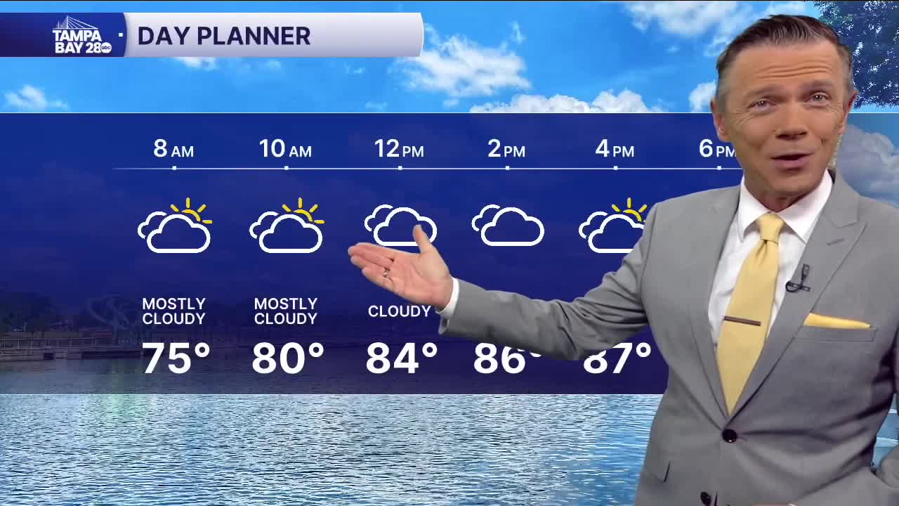


We're getting a bit of a break from the heat and humidity this morning. There is a nice north breeze and the dew points have dropped to the low 70s in most places, with a few locations even reporting upper 60s. That's making temperatures in the 70s feel a lot more comfortable.
Skies will be partly to mostly cloudy for the first half of the day as some clouds storms down in the Gulf get blown in our direction. Look for more sunshine the farther north you go today. North is also where it will remain dry for the afternoon. South of I-4 there will be sct'd t-storms developing late this afternoon and evening with higher coverage. Highs will reach the upper 80s to near 90.
Rain coverage will continue to drop as we move into Friday and continue to stay low through the weekend. We'll see some lower humidity this weekend too with temperatures falling to the 60s away from the coast on Saturday and Sunday morning. The afternoons will still be warm, near 90, with a slight chance of pop-up showers.
TROPICS: NHC is watching a tropical wave that will move off the coast of Africa this weekend. This system has a 30% chance of developing early next week as it moves west. Nothing to worry about right now and plenty of time to watch this one. The rest of the tropical Atlantic is quiet.
