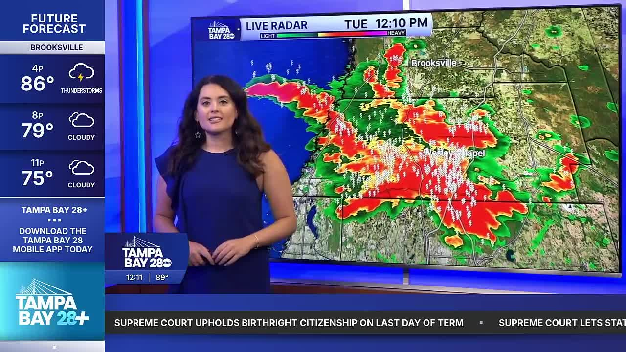


TAMPA — Good Tuesday afternoon Tampa Bay! The wetter pattern begins and showers and storms are moving through our area. Temps climb to 90 before the rain, after the rain, highs dip back into the 70s and 80s.
Scattered showers and thunderstorms become more widespread by the early afternoon. The heavier coverage is mainly due to a frontal boundary moving down along the east coast of Florida. This front will increase our rain chances today and tomorrow and even shift the winds to an offshore flow for a couple of days.
Look for offshore flow to take over on Wednesday. Wednesday will feature heavier rain coverage near the coast, but not until late in the day and into the evening. Because of the front moving south, the highest chances of rain will be south of the I-4 corridor.
The rain chances stay higher along the coast on Thursday. By Friday, however, and the holiday weekend, on-shore flow is back. That means warmer mornings and the heaviest rain east of I-75 for the afternoons and evenings.
I hope you have a great day!
