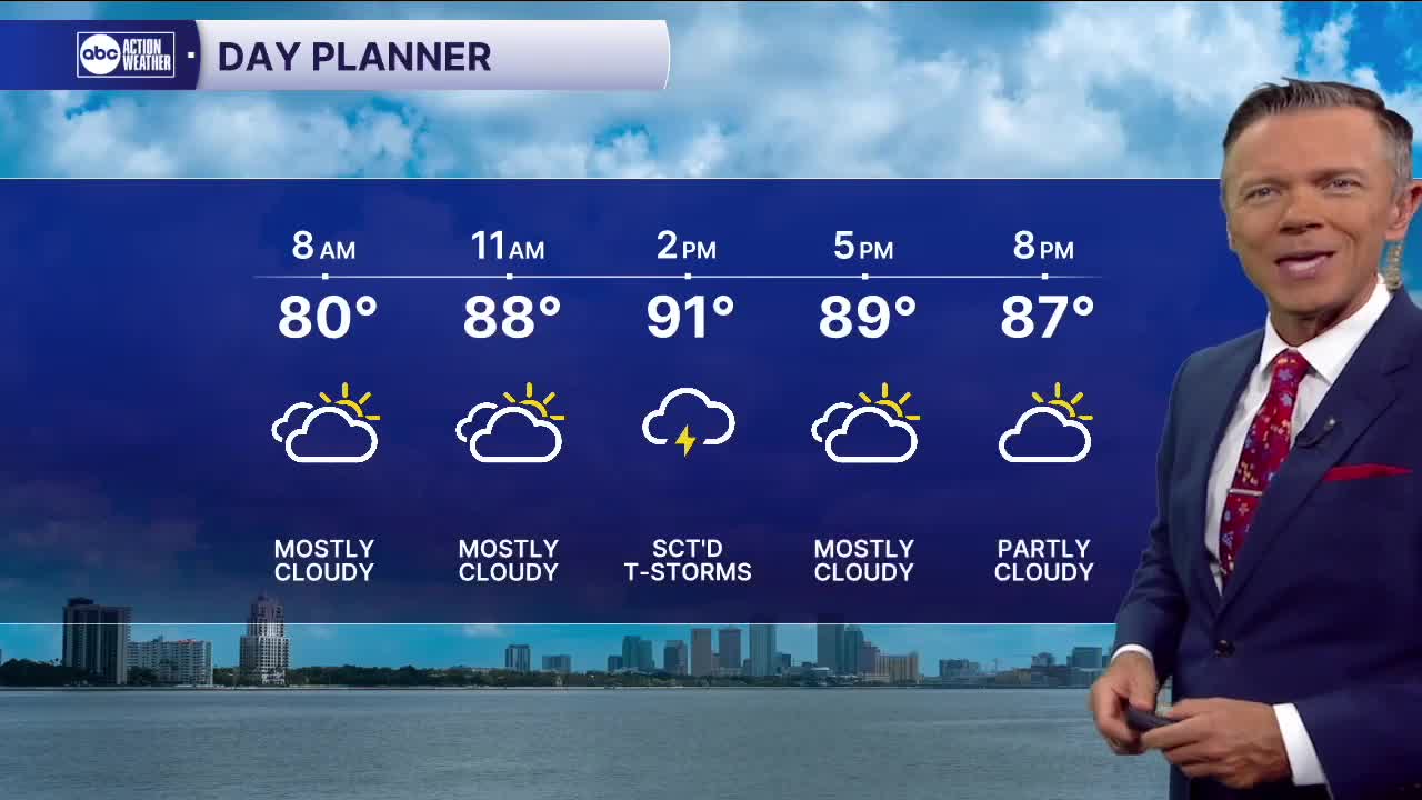


Sct'd storms return this afternoon.
We'll start the day mostly dry with temperatures generally in the mid and upper 70s. A few places will wake up to some fresh puddles from rain overnight.
We'll see a weak onshore flow today and through the end of the week. That means a higher chance of rain near the coast during the first half of the day. Any storms that do develop will generally shift east as we go toward the second half of the afternoon and evening. Highs will reach into the low and mid-90s.
This pattern continues into the weekend. By then, however, a weak front to our north may get close enough to slightly increase PM rain coverage on Saturday and Sunday. Highs will remain in the 90s. Neither day looks like a washout.
TROPICS: Erin continues to move west in the central Atlantic. The tropical storm is likely to become a hurricane in a couple days as it moves over warmer waters and away from some drier air. All data still indicates the system is likely to turn north as it passes north of the islands this weekend.
