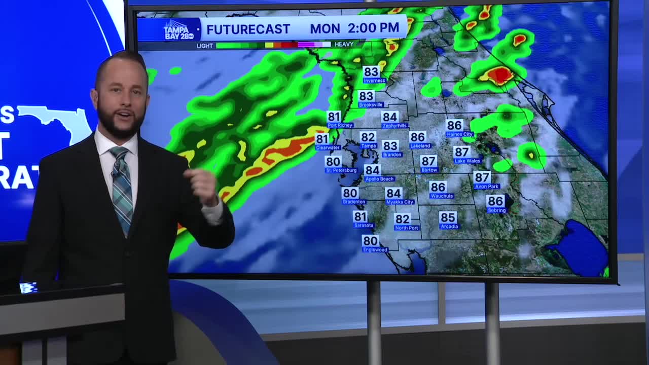


A strong cold front arrives Monday afternoon. It will bring gusty winds, widespread showers and thunderstorms, then a major cool down for Tuesday.
The front will bring gusty south winds ahead of it tomorrow. Keep that in mind if you had beach plans for Spring Break. The rip current risk will be much higher Monday and Tuesday than it was this weekend.
Showers and thunderstorms arrive between noon and 6 p.m. There is a chance for some storms to turn severe, but the overall risk is low. Any storm coming in off the Gulf tomorrow could produce wind gusts up to 60 mph and an isolated waterspout/tornado.
Behind the front, expect a major drop in temps! Highs will struggle to reach the low 60s Tuesday afternoon after being well into the 80s for the last two weeks. Overnight lows will dip into the 40s Tuesday and Wednesday morning, with some of our northern spots dipping below 40 Wednesday morning. No frost or freeze is expected.
Temps begin to warm up nicely Wednesday afternoon back up to around 70. The rest of Spring Break looks great with highs back to 80 by the weekend and sunny skies.
