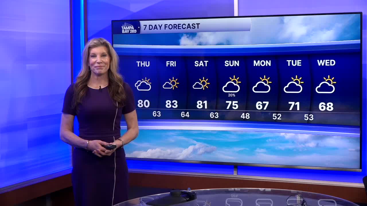


For the remainder of the afternoon, we'll see mostly sunny skies. Some areas may still have some hazy sunshine, but much less of that overall than yesterday. Highs will be in the upper 70s along the coast to the mid-80s east of I-75.
Tonight will be mild and muggy with lows in the upper 50s to the north and up to mid 60s along the coast. A chance for patchy fog overnight, but not the widespread dense fog we have had the last two mornings.
The warm and somewhat humid weather will continue into Friday and Saturday with highs in most towns in the 80s. The chance for dense fog decreases for the next few mornings, but it isn't completely out of the question.
On Sunday, a cold front will approach. We'll start the day mild and humid. Late in the day, as the front moves through, winds will shift and pick up from the north, allowing drier and cooler weather to start to move in. There will be a slight chance for a few light, brief showers but nothing heavy enough or long lasting enough to warrant changing plans over.
This front will set us up for cooler weather this week with chilly mornings and cool afternoons.
Have a great Thursday!
