


Milder weather today!
Today will feel like the "January thaw" you often hear people talk about up north when the cold weather takes a brief break.
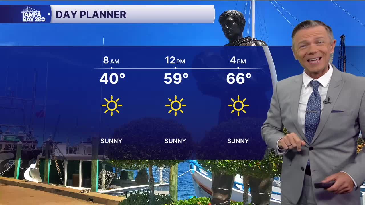
Not only will we see a ton of sun today, but winds will also be lighter and highs will reach 64-68 degrees. Some towns in our southern areas may even briefly get to 70!
Friday morning looks cold, but not freezing, with most towns starting the day in the upper 30s and low 40s. We'll see clouds moving by on Friday, but it'll still be mild, with highs in the upper 60s and low 70s.
Saturday will be wild, and I'm not just talking about Pirates invading Tampa, that may be the least wild event of the day! We'll start the day with mild temperatures. A few showers are likely through midday, though the rain doesn't look like a huge deal. We will likely see temperatures rise to near 60 midday, before the cold front blows through early in the afternoon.
This cold front will be the Captain Blackbeard of cold fronts, terrorizing Tampa like a true Pirate invasion for the rest of the day. Winds with the front will gust 30-40 mph at first, with gusts increasing to 40-50 mph by the evening. Bay waters will be very rough. Along with those winds, temperatures will fall to the 40s by 2 p.m. and the 30s by 8 p.m. It will always feel colder due to the wind.
With a wind off the Gulf and temps in the 30s, rain and even snow showers are possible from Tampa and points north through early Sunday morning. Sunday looks sunny, breezy and cold with temperatures in the 40s. Areas east of the coast on Sunday morning may wake up to a hard freeze.
Another freeze is likely on Monday morning with highs Monday in the 50s.
