


Much-needed rainfall is likely for some today!
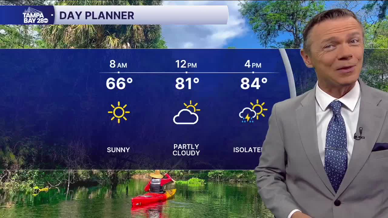
The morning and midday today will be dry. We'll start with comfortable temperatures in the 60s and warm into the low 80s by midday. The scattered pop-ups begin during the afternoon.
At first, they're most likely well to the east of I-75. But as the afternoon goes on, we'll see the rain spread closer to I-75 and eventually impact many along the I-75 corridor during the 4-8 pm time frame. Some of the rain may be locally heavy, with isolated locations picking up 1"+. Of course, because the rain will be scattered, some neighborhoods will miss out on it completely.
If you don't get rain today, the chances of any drop a lot begin Friday and continue through the weekend, with only a 10-20% chance of an afternoon shower on Friday, Saturday, and Sunday.
Early next week, it still looks like a weak front will settle over central Florida. Some of the models indicate that an area of low pressure may develop along or near this front. If it does, expect more cloud cover and higher rain coverage for at least one day, most likely Tuesday, next week. With the clouds and showers, it's also likely that we see one or two days of highs in the upper 70s.
Have a great Thursday!
