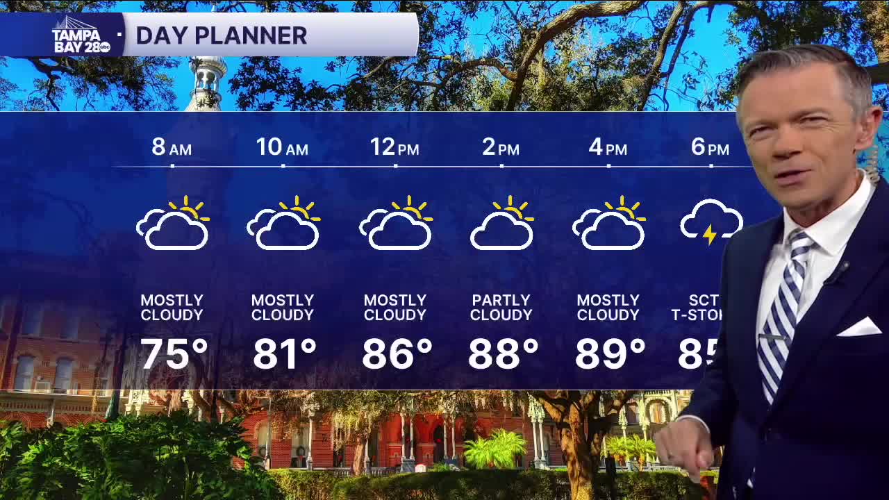


Look for dry weather to start this Thursday. Temperatures will be in the 70s early for most, though a few upper 60s are possible north of the Bay.
Skies will be partly to mostly cloudy this afternoon. This should keep temps a few degrees cooler than yesterday in most towns. Highs will reach near 90. We'll also see a few sct'd PM showers with most of the rain being east of I-75. Rain chances east will be around 30%.
Drier air starts to filter down into our area tomorrow as low pressure develops in the northern Bahamas. As the low moves north this weekend, it'll push drier and a little cooler air down into Florida.
Highs this weekend will be in the low to mid-80s with lows down in the 60s. Monday morning some towns north of the Bay will likely start the day in the 50s.
TROPICS: Jerry continues to look sheared and is not strengthening rapidly. The storm will pass close to the Leeward Islands overnight but the center should stay far enough NE to not cause major issues for any of the islands. It'll turn away from the US over the weekend and head out into the Atlantic.
