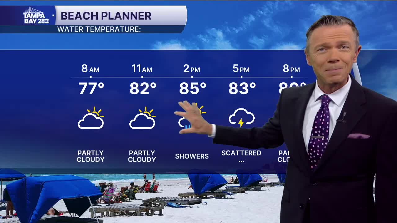


Look for dry and comfy weather on this Monday morning with temperatures starting in the 70s. There will be areas of clouds but rain is not expected for the morning.
Clouds will increase through the morning and by the afternoon some of these clouds will begin to produce sct'd rain and even some thunderstorms. Afternoon rain coverage looks high, at around 60%. Highs will reach the 80s.
Sct'd showers return on Tuesday afternoon though coverage will be lower than today. The driest day of the week is likely Wednesday with highs in the low 90s and only a 20% chance of PM rain.
Rain chances will increase again by the end of the week. This time, the rain will come from an actual cold front which will be the most significant one we've seen so far this fall season. The timing will line up well with the weekend. Highs on Saturday and Sunday will drop into the low and mid-80s. We'll see plenty of sun too. The best part however, will be the mornings when just about everyone will see temperatures in the 60s.
TROPICS: A broad low-pressure 1,800 miles east of the islands is likely to develop into Jerry this week. This system may be a threat to the Leeward Islands by the weekend. It will turn away from the continental U.S. and is nothing to worry about for Florida or the East Coast.
