


Milder weather is back.
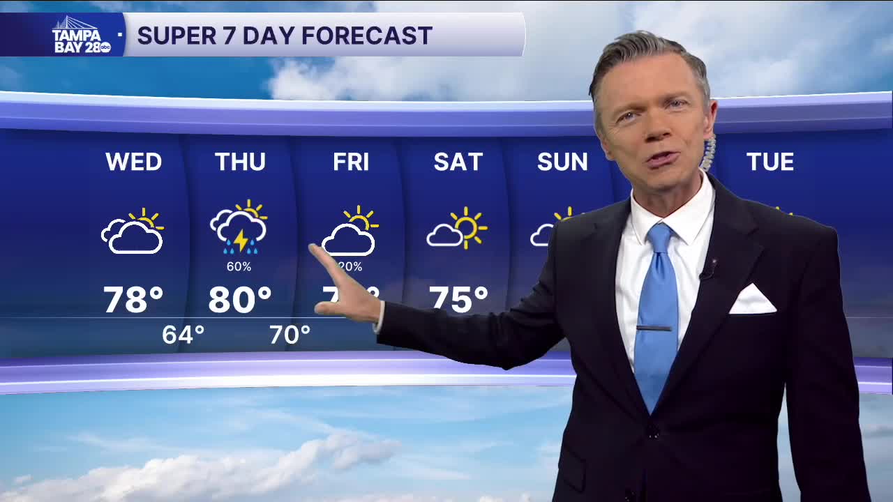
Temperatures this morning are starting milder, in the 50s. Look for a few areas of low clouds or even some patchy fog very early this morning. Otherwise, skies will be mostly sunny in the morning and then turn mostly cloudy during the afternoon. Highs will be mild with temperatures reaching the upper 70s by the afternoon.
A cold front will approach our area on Thursday. Out ahead of it, it'll be mild and mostly cloudy for much of Thursday. During the day, there is a 30% chance of scattered showers. Then, later in the evening and overnight, as the cold front moves through, some rain and even a thunderstorm is possible. Because this system will be moving through during the overnight, the rain looks to be more scattered, so not everyone will see it.
The front moves through on Friday morning. Behind it, drier and cooler weather begins to move down from the northwest. This will only be around through Saturday.
Look for the coolest temps of the weekend to happen on Saturday morning as we wake up to 40s and low 50s. Highs Saturday will warm into the low and mid-70s.
Warmer weather surges back on Sunday with highs approaching 80. This milder weather looks to stick around all of next week, with morning temperatures in the 50s and low 60s and afternoon highs in the upper 70s to near 80 degrees.
