


Less rain today, thanks to Erin.
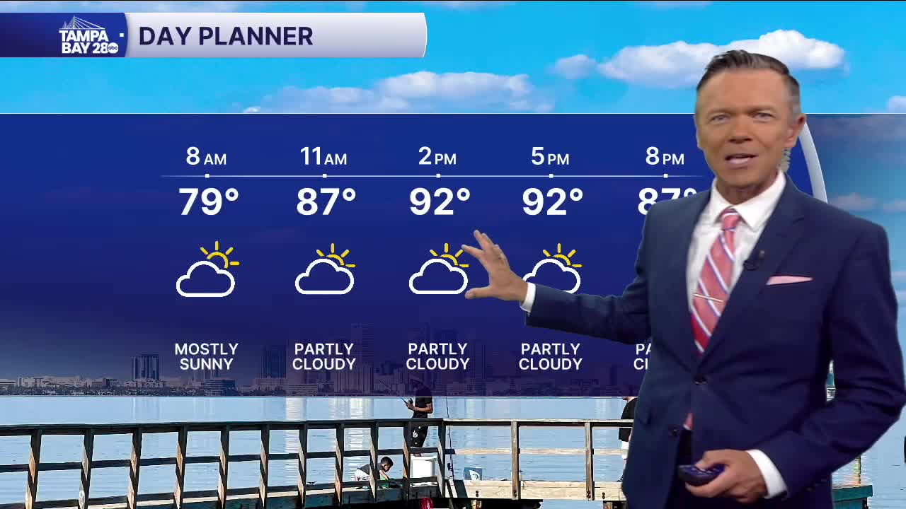
We're waking up to mostly dry weather this morning and temperatures in the 70s. Due to the outer flow around Erin we'll see lower rain coverage in our area today. There will only be a 20% chance of a pop-up shower. Because there will be less rain, highs will climb into the low and mid-90s and stay that way into the late afternoon and evening.
Rain chances begin to pick back up on Thursday and climb again into Friday, staying high through the weekend. This will be the result of a strong on-shore flow and a moisture feed that will be connected to Erin and a frontal system to our north, leading off the east coast.
Friday through the weekend especially we'll see higher than normal rain coverage, with the rain likely impacting most earlier in the day. With more rain early, that also means more clouds and thus temperatures that actually may run below where they should be for this time of year, in the upper 80s.
TROPICS: Erin will move between Bermuda and the Outer Banks over the next couple of days. The storm will mostly bring very high surf, which may lead to beach erosion and some coastal flooding. Winds may also gust over 50 mph, especially in eastern North Carolina.
There are two more tropical waves in the Atlantic behind Erin. Though both are expected to develop, neither looks to be a threat to land at this time.
