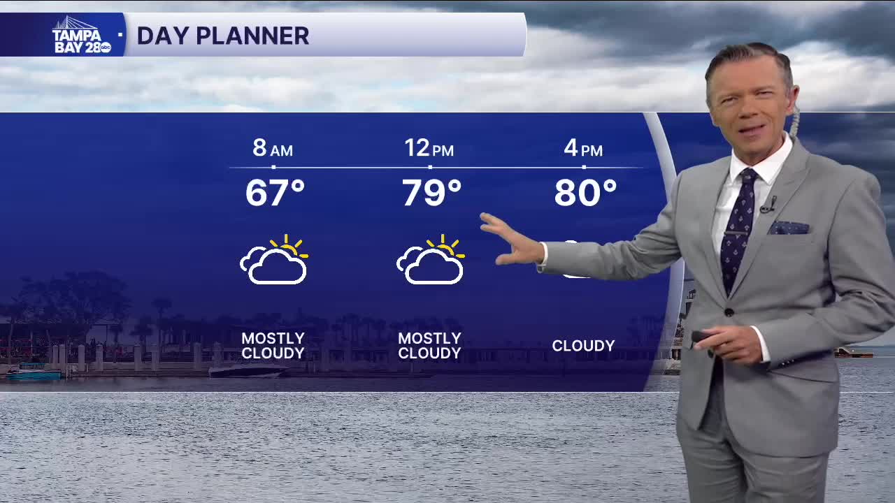


Mostly cloudy skies today. We'll start the day with temperatures in the 60s and warm to near 80 this afternoon. Because of the clouds, temperatures are likely to be a degree or two lower than yesterday. A quick sprinkle is possible out of any of these clouds, especially this afternoon.
Clouds will hang around through the first half of Friday, with maybe even a couple of showers Friday morning. Those showers and clouds will move out by Friday afternoon, with partly sunny and warm weather returning. Friday's highs will reach the mid-80s.
Saturday definitely looks like the best day of the weekend. It'll be warm and more humid with mostly sunny skies and highs in the 80s.
Sunday still looks ok, though with a cold front on the way late in the day, I cannot rule out a couple of showers during the afternoon. Highs on Sunday will reach the 80s, and it will be a bit more breeze too because of the front.
Cold front moves through late Sunday and early Monday with our first blast of arctic air for the season.
Highs Monday will stay in the 60s, and Tuesday may see temperatures near record lows in the morning, ranging between 38 and 42 degrees. It'll feel colder with the wind. Tuesday will be beautiful, sunny, and chilly. We'll see one more cold night Tuesday night and then a warm-up back into the 70s by late Wednesday.
TROPICS: No development expected over the next 7 days.
