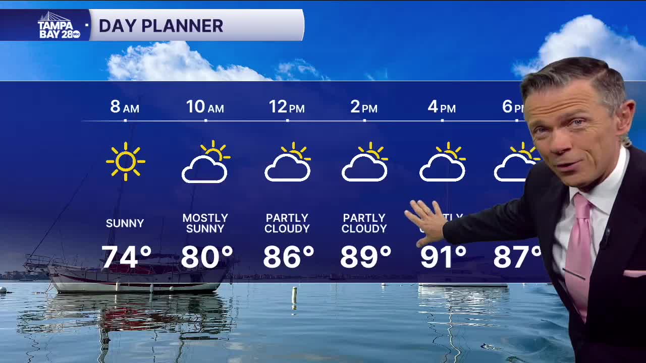


Look for a dry and clear start on this Wednesday. Temperatures early will be in the 70s with even a few upper 60s north of the Bay. There will be a light northeast wind too.
Skies this afternoon will be mostly sunny. Rain coverage will be way down to 10% or less. Combine this drier weather with a continued offshore flow and highs today may be well above where they should be near the coast, in the low 90s.
A front will move through the area late Thursday into Friday. A few showers are possible with this front. Overall, though, the biggest change with this front will be the humidity. Drier air will move in Friday into Saturday. The drier air will provide for much more comfortable afternoons this weekend. It'll still be warm though with highs in the mid-80s. It's the morning when you'll really feel the change. Most towns will start the days in the 60s beginning Saturday morning and going right into the middle of next week.
With drier air around, rainfall is not expected this weekend and the first half of next week.
TROPICS: Tropical Storm Jerry continues to get closer to the islands. It's expected to pass near the northeast Leeward Islands early on Friday as maybe a Category 1 hurricane. After that, a turn to the northeast and away from the United States is expected this weekend.
