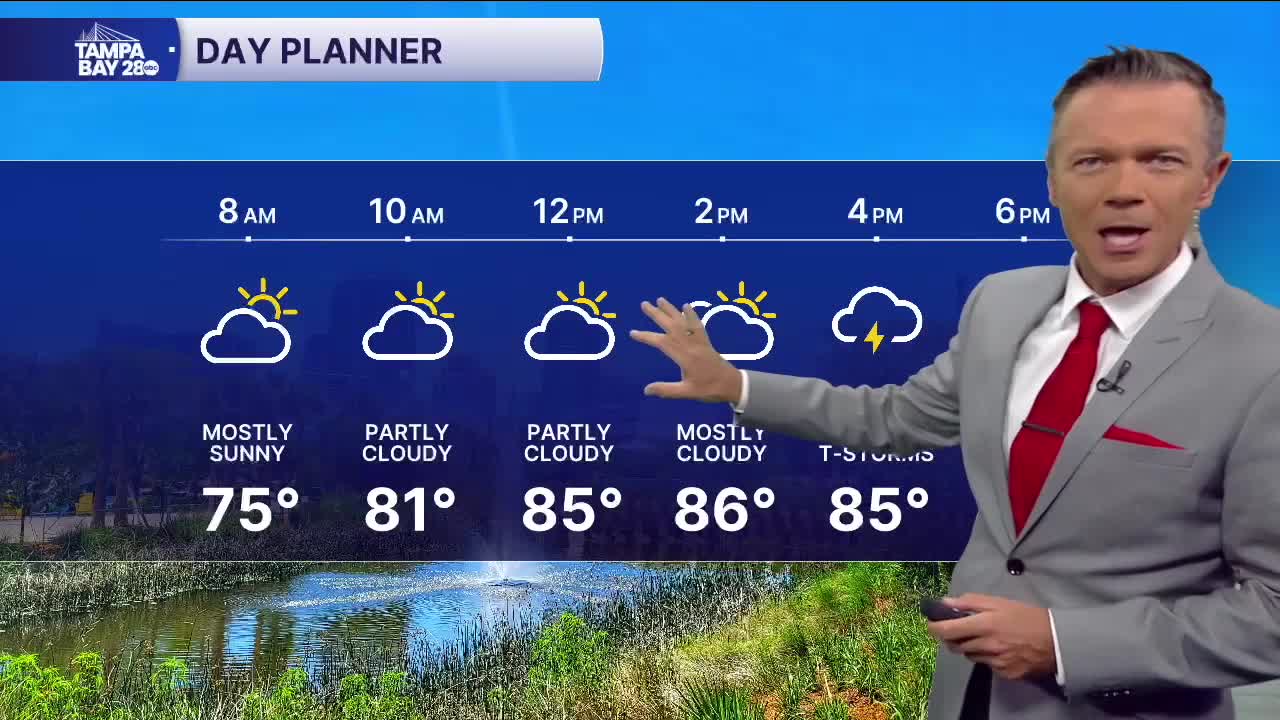


Dry and comfy to start the day with temperatures in the 70s. Look for breezy conditions this afternoon with occasional gusts of 20 mph+. Small craft advisories are up for Gulf and Bay waters today.
Highs will reach the upper 80s. We'll see dry and partly sunny weather during the first half of the day. Sct'd showers will be likely later in the afternoon and evening. Some of these will make it all the way west to the beaches, though overall, the highest rain chance will be east of I-75.
Look for similar weather on Friday with most of the sct'd rain in the afternoon.
As we go into the weekend, a weak area of low pressure will be crossing the state. It's unlikely this will develop into anything tropical, but it will increase moisture levels across the state and give us much higher chance of rain. Saturday and Sunday rain chances stand at 60%. Neither day will be a washout, but we will be dodging showers, especially each afternoon.
TROPICS: Imelda moved over Bermuda overnight and is now away from the island. It will weaken as it moves toward colder waters.
There is a 10% chance of development with an area of low pressure that will cross Florida this weekend. This system is not a concern and will only increase rain coverage across the state.
Farther out in the Atlantic there will be another tropical wave that will move off the coast of Africa this weekend. This system may develop over the Atlantic next week. It is not a threat to the United States right now.
