


A few scattered storms return today.
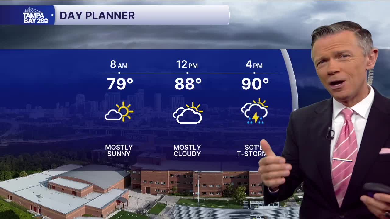
We'll see a similar setup today to yesterday. The day will start in the 70s with no rain in the morning and mostly dry conditions through midday. Temperatures will reach the low 90s early in the afternoon. Scattered pop-ups are possible with the west coast sea breeze after lunch. Then, later in the afternoon, as the east coast sea breeze arrives, additional showers and storms are likely, with the heaviest coverage today from the Bay and I-4 corridors and points south.
The winds turn more southeast on Friday. This will maximize rain coverage and push up the timing to earlier in the day. Coverage may be 60-70% with highs around 90.
As for the holiday weekend, we switch back to onshore flow and southwest winds. This means a chance of showers along the coast in the morning. Check the radar before you head out Saturday morning; there may be some rain and lightning along the coast. A waterspout is also possible. By the afternoon and especially the evening, I think most of the rain will be well to the east of us, giving us a pretty good forecast for fireworks displays on Saturday evening along our coast.
Have a great Thursday!
