


Rain is more likely this afternoon.
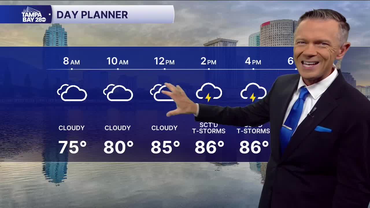
We're starting this Wednesday with higher humidity, especially south of I-4, & temperatures in the 70s. Skies are partly cloudy early but expect the clouds to increase as we go toward midday & the afternoon.
Sct'd rain & storms will be likely later today as higher levels of moisture move in from the south. Some of the rain will be locally heavy leading to localized flooding. Because of the higher rain coverage, temps in many towns will likely stay into the 80s.
Today will likely be the only day with higher rain coverage. Overall, rain chances will drop as we go into Thursday & will stay lower as we move through the weekend. The trade-off will be hotter temps as most days will see a high above where it should be for this time of year, in the low 90s.
TROPICS: The tropical wave in the Atlantic that we've been watching over the last several days is now tropical depression 7 & will likely become Tropical Storm Gabrielle later today or tomorrow. The system is getting better organized as expected. There has been no change to the thinking on the track & the latest NHC forecast cone confirms this, keeping the system well northeast of the islands & the Bahamas. A turn away from the US East Coast is still the most likely solution here. Nothing to worry about.
