


Offshore flow is here for a few days.
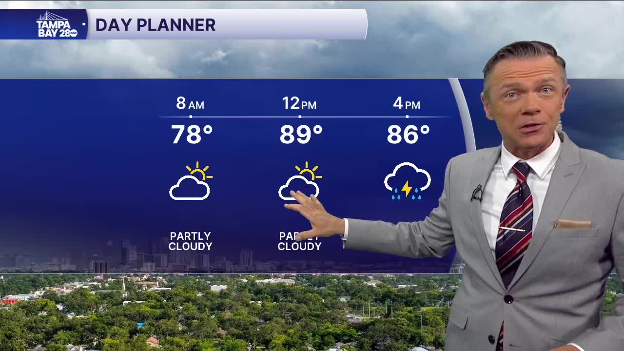
East-to-west flow means cooler temperatures for everyone this morning. All towns are down into the 70s, 3-6 degrees lower than any morning in the last week. Highs return to the low 90s this afternoon before the rain arrives.
Speaking of the rain, there are some changes with that, too. In this kind of weather pattern, storms arrive later in the day for most people. A few towns, in the early afternoon, may see a pop-up downpour along the Highway 19 corridor as our sea breeze kicks in and hangs out near the coast.
Later in the afternoon, as the east coast sea breeze arrives in our area, we'll see scattered rain and storms. These will most likely be between 3 p.m. and 7 p.m. for most along the I-75 corridor and the beaches. Some beaches will absolutely get rained on later this afternoon or evening.
This pattern will return on Thursday and on Friday. By the weekend, the wind pattern becomes a bit fuzzier and weaker, so we may see the storms pop up in a more scattered manner each afternoon. Either way, there will absolutely be scattered rain around on July 4th, so some outdoor plans and fireworks displays may be impacted. Check the radar often!
