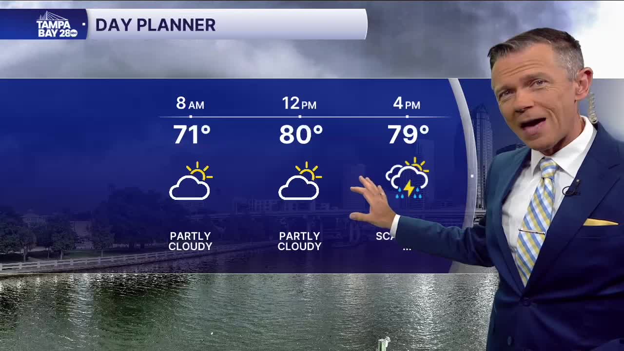


Dry through midday, then some PM storms.
A large part of our area is under a level 2 out of 5 risk of severe weather today.
No rain through midday today. If you don't want to be out in the rain and storms later today, get all your errands, plans, appointments done before 2 pm while the weather is warm and dry.
Later this afternoon and evening, a line of rain and storms will move through the area. Along this line there may be strong damaging winds and an isolated waterspout or tornado or two.
Once the storms move through, expect winds to pick up from the NW and arctic air will begin to make a return to our area.
Tuesday will be COLD! Morning temperatures will range from the upper 30s in Citrus to the 40s elsewhere. Many of those in the 40s will experience wind chills at times in the upper 30s. Tuesday will dry out and see a mix of clouds and sun, but the temperatures will not move much. Look for highs of only 60-65°F, which is 10- 15°F below normal.
Wednesday will not be much warmer. The warming really returns on Thursday with highs back in the 70s on Thursday afternoon and then near 80 by the weekend.
